
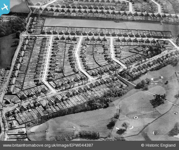
EPW044387 ENGLAND (1934). The Montrose Park Estate between Hurst Road and Faraday Lane, Sidcup, 1934
© Hawlfraint cyfranwyr OpenStreetMap a thrwyddedwyd gan yr OpenStreetMap Foundation. 2025. Trwyddedir y gartograffeg fel CC BY-SA.
Delweddau cyfagos (9)
EPW044387

EPW044386

EPW044384

EPW044380

EPW044381

EPW044383

EPW044385

EPW038430

EPW038192

Manylion
| Pennawd | [EPW044387] The Montrose Park Estate between Hurst Road and Faraday Lane, Sidcup, 1934 |
| Cyfeirnod | EPW044387 |
| Dyddiad | May-1934 |
| Dolen | |
| Enw lle | SIDCUP |
| Plwyf | |
| Ardal | |
| Gwlad | ENGLAND |
| Dwyreiniad / Gogleddiad | 547177, 173064 |
| Hydred / Lledred | 0.11770619084035, 51.436937939505 |
| Cyfeirnod Grid Cenedlaethol | TQ472731 |
Pinnau
 sakkysea |
Tuesday 20th of January 2015 02:12:21 PM | |
sakkysea |
Tuesday 20th of January 2015 02:11:22 PM | |
sakkysea |
Tuesday 20th of January 2015 02:10:10 PM | |
sakkysea |
Tuesday 20th of January 2015 02:01:52 PM |