
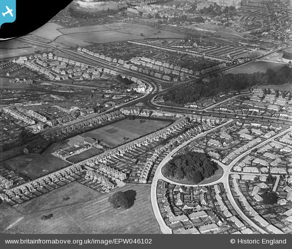
EPW046102 ENGLAND (1934). Harrow Road, Wollaton Road and environs, Wollaton, from the south-west, 1934
© Hawlfraint cyfranwyr OpenStreetMap a thrwyddedwyd gan yr OpenStreetMap Foundation. 2025. Trwyddedir y gartograffeg fel CC BY-SA.
Delweddau cyfagos (2)
EPW046102

EPW046101

Manylion
| Pennawd | [EPW046102] Harrow Road, Wollaton Road and environs, Wollaton, from the south-west, 1934 |
| Cyfeirnod | EPW046102 |
| Dyddiad | September-1934 |
| Dolen | |
| Enw lle | WOLLATON |
| Plwyf | |
| Ardal | |
| Gwlad | ENGLAND |
| Dwyreiniad / Gogleddiad | 454107, 339821 |
| Hydred / Lledred | -1.1945556583573, 52.952721267027 |
| Cyfeirnod Grid Cenedlaethol | SK541398 |
Pinnau
 ainsleylad |
Monday 8th of August 2016 07:17:19 PM |