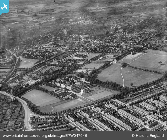
EPW047646 ENGLAND (1935). Victoria Park, University College Leicester and Welford Road Cemetery, Leicester, from the south-east, 1935
© Hawlfraint cyfranwyr OpenStreetMap a thrwyddedwyd gan yr OpenStreetMap Foundation. 2025. Trwyddedir y gartograffeg fel CC BY-SA.
Delweddau cyfagos (6)
Manylion
| Pennawd | [EPW047646] Victoria Park, University College Leicester and Welford Road Cemetery, Leicester, from the south-east, 1935 |
| Cyfeirnod | EPW047646 |
| Dyddiad | June-1935 |
| Dolen | |
| Enw lle | LEICESTER |
| Plwyf | |
| Ardal | |
| Gwlad | ENGLAND |
| Dwyreiniad / Gogleddiad | 459470, 302623 |
| Hydred / Lledred | -1.1214922611506, 52.617762912611 |
| Cyfeirnod Grid Cenedlaethol | SK595026 |
Pinnau
 diag |
Sunday 27th of October 2013 04:09:55 PM | |
 diag |
Sunday 27th of October 2013 04:08:58 PM | |
 diag |
Sunday 27th of October 2013 04:06:47 PM | |
 diag |
Sunday 27th of October 2013 04:05:56 PM |


![[EPW047646] Victoria Park, University College Leicester and Welford Road Cemetery, Leicester, from the south-east, 1935](http://britainfromabove.org.uk/sites/all/libraries/aerofilms-images/public/100x100/EPW/047/EPW047646.jpg)
![[EPW047647] Victoria Park, University College Leicester and Welford Road Cemetery, Leicester, from the south-east, 1935](http://britainfromabove.org.uk/sites/all/libraries/aerofilms-images/public/100x100/EPW/047/EPW047647.jpg)
![[EPW047648] Victoria Park, University College Leicester, Welford Road Cemetery and environs, Leicester, from the south-west, 1935](http://britainfromabove.org.uk/sites/all/libraries/aerofilms-images/public/100x100/EPW/047/EPW047648.jpg)
![[EPW047649] Victoria Park, University College Leicester, Welford Road Cemetery and environs, Leicester, from the south-west, 1935](http://britainfromabove.org.uk/sites/all/libraries/aerofilms-images/public/100x100/EPW/047/EPW047649.jpg)
![[EPW014911] University College and Victoria Park, Leicester, 1926](http://britainfromabove.org.uk/sites/all/libraries/aerofilms-images/public/100x100/EPW/014/EPW014911.jpg)
![[EPW055017] The Wyggeston Grammar School for Boys and University College Leicester, Leicester, 1937](http://britainfromabove.org.uk/sites/all/libraries/aerofilms-images/public/100x100/EPW/055/EPW055017.jpg)