
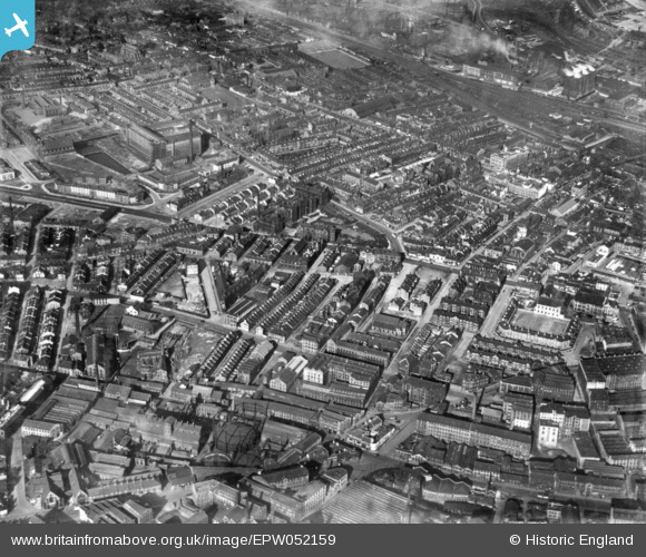
EPW052159 ENGLAND (1936). Bradford Royal Infirmary and environs, Bradford, 1936. This image has been produced from a print.
© Hawlfraint cyfranwyr OpenStreetMap a thrwyddedwyd gan yr OpenStreetMap Foundation. 2025. Trwyddedir y gartograffeg fel CC BY-SA.
Delweddau cyfagos (4)
EPW052159

EPW057185

EPW054320

EPW057190

Manylion
| Pennawd | [EPW052159] Bradford Royal Infirmary and environs, Bradford, 1936. This image has been produced from a print. |
| Cyfeirnod | EPW052159 |
| Dyddiad | October-1936 |
| Dolen | |
| Enw lle | BRADFORD |
| Plwyf | |
| Ardal | |
| Gwlad | ENGLAND |
| Dwyreiniad / Gogleddiad | 415722, 433467 |
| Hydred / Lledred | -1.7612870849415, 53.797057318801 |
| Cyfeirnod Grid Cenedlaethol | SE157335 |
Pinnau
 alpaul |
Wednesday 19th of July 2023 11:25:08 PM | |
alpaul |
Wednesday 19th of July 2023 11:23:14 PM | |
Shipley Flyer |
Sunday 18th of June 2023 09:41:04 AM |