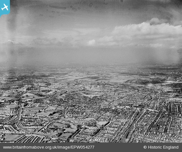
EPW054277 ENGLAND (1937). An infrared photograph over Cheam and central Sutton, Sutton, from the south-west, 1937
© Hawlfraint cyfranwyr OpenStreetMap a thrwyddedwyd gan yr OpenStreetMap Foundation. 2024. Trwyddedir y gartograffeg fel CC BY-SA.
Manylion
| Pennawd | [EPW054277] An infrared photograph over Cheam and central Sutton, Sutton, from the south-west, 1937 |
| Cyfeirnod | EPW054277 |
| Dyddiad | 13-July-1937 |
| Dolen | |
| Enw lle | SUTTON |
| Plwyf | |
| Ardal | |
| Gwlad | ENGLAND |
| Dwyreiniad / Gogleddiad | 525343, 164307 |
| Hydred / Lledred | -0.1993723662884, 51.363481228021 |
| Cyfeirnod Grid Cenedlaethol | TQ253643 |
Pinnau
 christhewino |
Monday 9th of January 2023 10:40:47 AM | |
 Kim |
Sunday 6th of June 2021 09:00:57 PM | |
 Casper |
Sunday 19th of November 2017 11:54:02 AM | |
 Mark1973 |
Thursday 8th of August 2013 03:57:14 PM |


![[EPW054277] An infrared photograph over Cheam and central Sutton, Sutton, from the south-west, 1937](http://britainfromabove.org.uk/sites/all/libraries/aerofilms-images/public/100x100/EPW/054/EPW054277.jpg)
![[EPW001678] Tate Road area of Sutton, Sutton, 1920](http://britainfromabove.org.uk/sites/all/libraries/aerofilms-images/public/100x100/EPW/001/EPW001678.jpg)
![[EPW050019] St James' Road and the town, Sutton, 1936. This image has been produced from a print.](http://britainfromabove.org.uk/sites/all/libraries/aerofilms-images/public/100x100/EPW/050/EPW050019.jpg)
![[EPW028248] The Wimbledon and Sutton Railway and surrounding residential area, Sutton, 1929](http://britainfromabove.org.uk/sites/all/libraries/aerofilms-images/public/100x100/EPW/028/EPW028248.jpg)