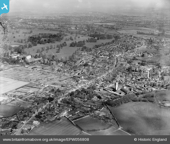
EPW056808 ENGLAND (1938). The town and Farnham Park, Farnham, from the south-west, 1938. This image has been produced from a damaged negative.
© Hawlfraint cyfranwyr OpenStreetMap a thrwyddedwyd gan yr OpenStreetMap Foundation. 2025. Trwyddedir y gartograffeg fel CC BY-SA.
Manylion
| Pennawd | [EPW056808] The town and Farnham Park, Farnham, from the south-west, 1938. This image has been produced from a damaged negative. |
| Cyfeirnod | EPW056808 |
| Dyddiad | 10-April-1938 |
| Dolen | |
| Enw lle | FARNHAM |
| Plwyf | FARNHAM |
| Ardal | |
| Gwlad | ENGLAND |
| Dwyreiniad / Gogleddiad | 483669, 146641 |
| Hydred / Lledred | -0.80200865845369, 51.212319277025 |
| Cyfeirnod Grid Cenedlaethol | SU837466 |
Pinnau
 Sweet Pete |
Saturday 14th of November 2015 03:09:00 PM | |
 Sweet Pete |
Saturday 14th of November 2015 03:07:34 PM | |
 Sweet Pete |
Saturday 14th of November 2015 03:07:06 PM | |
 flubber |
Tuesday 24th of December 2013 07:13:45 PM | |
 flubber |
Monday 8th of July 2013 07:17:33 PM | |
 flubber |
Monday 8th of July 2013 07:14:53 PM | |
 flubber |
Monday 8th of July 2013 07:09:47 PM | |
 flubber |
Monday 8th of July 2013 07:08:42 PM | |
 flubber |
Monday 8th of July 2013 07:07:12 PM | |
 flubber |
Monday 8th of July 2013 07:05:33 PM | |
 flubber |
Monday 8th of July 2013 07:04:51 PM | |
 flubber |
Monday 8th of July 2013 07:03:15 PM | |
 flubber |
Monday 8th of July 2013 07:02:36 PM |


![[EPW056808] The town and Farnham Park, Farnham, from the south-west, 1938. This image has been produced from a damaged negative.](http://britainfromabove.org.uk/sites/all/libraries/aerofilms-images/public/100x100/EPW/056/EPW056808.jpg)
![[EPW032698] The town centre, Farnham, 1930](http://britainfromabove.org.uk/sites/all/libraries/aerofilms-images/public/100x100/EPW/032/EPW032698.jpg)
![[EPW032700] The town, Farnham, from the south-west, 1930](http://britainfromabove.org.uk/sites/all/libraries/aerofilms-images/public/100x100/EPW/032/EPW032700.jpg)