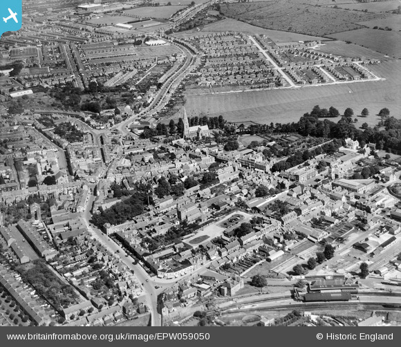
EPW059050 ENGLAND (1938). Old Town, Swindon, 1938
© Hawlfraint cyfranwyr OpenStreetMap a thrwyddedwyd gan yr OpenStreetMap Foundation. 2025. Trwyddedir y gartograffeg fel CC BY-SA.
Delweddau cyfagos (5)
Manylion
| Pennawd | [EPW059050] Old Town, Swindon, 1938 |
| Cyfeirnod | EPW059050 |
| Dyddiad | 30-August-1938 |
| Dolen | |
| Enw lle | SWINDON |
| Plwyf | |
| Ardal | |
| Gwlad | ENGLAND |
| Dwyreiniad / Gogleddiad | 415702, 183757 |
| Hydred / Lledred | -1.7735082066634, 51.552005067745 |
| Cyfeirnod Grid Cenedlaethol | SU157838 |
Pinnau
 Gary |
Tuesday 16th of January 2024 04:42:50 PM | |
 Gary |
Tuesday 16th of January 2024 04:42:05 PM | |
 NottmJas |
Saturday 16th of September 2023 11:44:53 PM | |
 NottmJas |
Saturday 16th of September 2023 11:35:31 PM | |
 NottmJas |
Saturday 16th of September 2023 11:32:56 PM | |
 NottmJas |
Monday 2nd of May 2022 09:50:57 PM | |
 NottmJas |
Monday 2nd of May 2022 09:48:37 PM | |
 gBr |
Monday 11th of March 2019 09:31:29 PM | |
 gBr |
Monday 11th of March 2019 09:29:38 PM | |
 kingcole |
Sunday 25th of August 2013 03:58:47 PM | |
 Isleworth1961 |
Wednesday 12th of June 2013 09:42:09 AM |


![[EPW059050] Old Town, Swindon, 1938](http://britainfromabove.org.uk/sites/all/libraries/aerofilms-images/public/100x100/EPW/059/EPW059050.jpg)
![[EPW010119] General view of Swindon from Christ Church and the High Street area, Swindon, from the south-east, 1924](http://britainfromabove.org.uk/sites/all/libraries/aerofilms-images/public/100x100/EPW/010/EPW010119.jpg)
![[EPW010117] General view of Swindon from the High Street and environs, Swindon, 1924](http://britainfromabove.org.uk/sites/all/libraries/aerofilms-images/public/100x100/EPW/010/EPW010117.jpg)
![[EPW059048] Old Town, Swindon, 1938](http://britainfromabove.org.uk/sites/all/libraries/aerofilms-images/public/100x100/EPW/059/EPW059048.jpg)
![[EPW010112] View of Swindon from Christ Church and the Belle Vue Avenue area, Swindon, from the south-east, 1924](http://britainfromabove.org.uk/sites/all/libraries/aerofilms-images/public/100x100/EPW/010/EPW010112.jpg)