
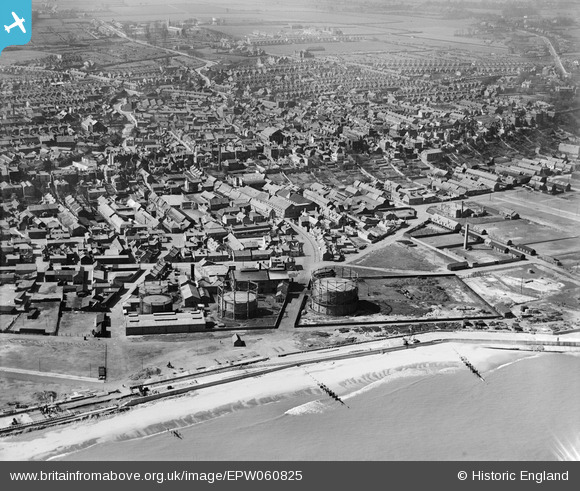
EPW060825 ENGLAND (1939). Lowestoft Water and Gas Co Gas Works on Ness Point and environs, Lowestoft, from the south-east, 1939
© Hawlfraint cyfranwyr OpenStreetMap a thrwyddedwyd gan yr OpenStreetMap Foundation. 2025. Trwyddedir y gartograffeg fel CC BY-SA.
Delweddau cyfagos (11)
EPW060825

EPW060828

EPW060827

EPW060823

EPW060829

EPW060826

EPW060824

EPW016550

EPW021251

EAW047601

EAW047605

Manylion
| Pennawd | [EPW060825] Lowestoft Water and Gas Co Gas Works on Ness Point and environs, Lowestoft, from the south-east, 1939 |
| Cyfeirnod | EPW060825 |
| Dyddiad | 21-April-1939 |
| Dolen | |
| Enw lle | LOWESTOFT |
| Plwyf | |
| Ardal | |
| Gwlad | ENGLAND |
| Dwyreiniad / Gogleddiad | 655529, 293496 |
| Hydred / Lledred | 1.7635262868896, 52.47907720513 |
| Cyfeirnod Grid Cenedlaethol | TM555935 |
Pinnau
 sajay |
Sunday 19th of September 2021 07:25:51 AM | |
Eddy |
Thursday 20th of August 2020 07:18:36 PM | |
Eddy |
Wednesday 19th of August 2020 09:39:46 PM | |
Eddy |
Wednesday 19th of August 2020 09:37:31 PM | |
Eddy |
Wednesday 19th of August 2020 09:33:59 PM | |
Eddy |
Wednesday 19th of August 2020 09:33:05 PM | |
Eddy |
Wednesday 19th of August 2020 09:31:15 PM | |
Eddy |
Wednesday 19th of August 2020 09:29:05 PM | |
Eddy |
Wednesday 19th of August 2020 09:27:41 PM | |
Eddy |
Wednesday 19th of August 2020 09:26:01 PM | |
Peter |
Wednesday 30th of October 2013 03:44:48 PM | |
peterjt |
Thursday 3rd of October 2013 04:11:52 PM | |
peterjt |
Thursday 3rd of October 2013 04:08:41 PM |

