
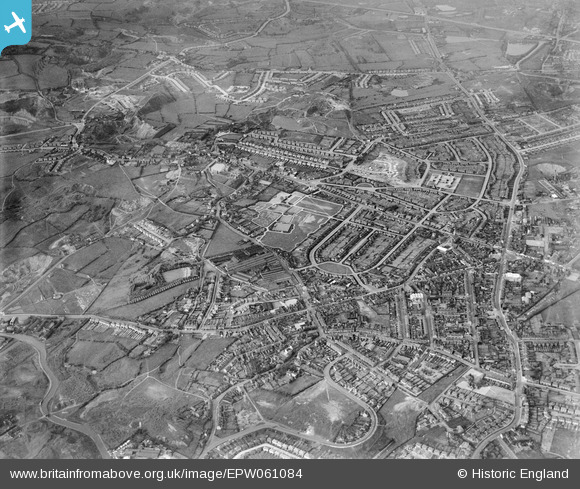
EPW061084 ENGLAND (1939). The town, Blackheath, from the south-west, 1939
© Hawlfraint cyfranwyr OpenStreetMap a thrwyddedwyd gan yr OpenStreetMap Foundation. 2025. Trwyddedir y gartograffeg fel CC BY-SA.
Delweddau cyfagos (10)
EPW061084

EPW061083

EAW020386
, Beeches Road and environs, Blackheath, 1948. This image was marked by Aerofilms Ltd for photo editing.")
EAW020388
 and environs, Blackheath, 1948. This image was marked by Aerofilms Ltd for photo editing.")
EAW020383
, Holly Road, Beeches Road and environs, Blackheath, 1948. This image was marked by Aerofilms Ltd for photo editing.")
EAW020385
, Holly Road, Beeches Road and environs, Blackheath, 1948. This image was marked by Aerofilms Ltd for photo editing.")
EAW020384
, High Street and environs, Blackheath, 1948. This image was marked by Aerofilms Ltd for photo editing.")
EAW020382
, High Street and environs, Blackheath, 1948. This image was marked by Aerofilms Ltd for photo editing.")
EAW020389
, High Street and environs, Blackheath, from the north, 1948. This image was marked by Aerofilms Ltd for photo editing.")
EAW020387
, High Street and environs, Blackheath, 1948. This image was marked by Aerofilms Ltd for photo editing.")
Manylion
| Pennawd | [EPW061084] The town, Blackheath, from the south-west, 1939 |
| Cyfeirnod | EPW061084 |
| Dyddiad | May-1939 |
| Dolen | |
| Enw lle | BLACKHEATH |
| Plwyf | |
| Ardal | |
| Gwlad | ENGLAND |
| Dwyreiniad / Gogleddiad | 396776, 286356 |
| Hydred / Lledred | -2.0474708180372, 52.474755621092 |
| Cyfeirnod Grid Cenedlaethol | SO968864 |
Pinnau
 DKH |
Friday 9th of December 2022 03:50:13 PM | |
PJ |
Saturday 18th of April 2020 06:18:41 PM | |
keithbeckett |
Sunday 30th of September 2018 12:49:03 PM | |
Mr Jauncey |
Saturday 8th of February 2014 07:57:27 PM | |
Phill |
Wednesday 1st of January 2014 08:44:53 PM | |
DaveT |
Sunday 20th of October 2013 07:13:57 PM | |
DaveT |
Sunday 20th of October 2013 07:11:48 PM | |
DaveT |
Sunday 20th of October 2013 07:09:53 PM | |
DaveT |
Sunday 20th of October 2013 07:08:41 PM | |
DaveT |
Sunday 20th of October 2013 07:07:22 PM |