
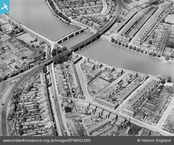
EPW061396 ENGLAND (1939). Gaskell Road, Penwortham Bridge, the railway viaduct and environs, Lower Penwortham, 1939
© Hawlfraint cyfranwyr OpenStreetMap a thrwyddedwyd gan yr OpenStreetMap Foundation. 2025. Trwyddedir y gartograffeg fel CC BY-SA.
Delweddau cyfagos (4)
EPW061396

EPW061397

EPW061398

EPW061399

Manylion
| Pennawd | [EPW061396] Gaskell Road, Penwortham Bridge, the railway viaduct and environs, Lower Penwortham, 1939 |
| Cyfeirnod | EPW061396 |
| Dyddiad | 2-June-1939 |
| Dolen | |
| Enw lle | LOWER PENWORTHAM |
| Plwyf | PENWORTHAM |
| Ardal | |
| Gwlad | ENGLAND |
| Dwyreiniad / Gogleddiad | 353068, 428151 |
| Hydred / Lledred | -2.7117501373468, 53.747395948146 |
| Cyfeirnod Grid Cenedlaethol | SD531282 |
Pinnau
 peter |
Sunday 29th of December 2024 11:13:30 AM | |
Robert - Cumbria |
Thursday 6th of February 2014 08:44:26 PM | |
Robert - Cumbria |
Thursday 6th of February 2014 08:41:26 PM | |
Robert - Cumbria |
Thursday 6th of February 2014 08:39:46 PM | |
Robert - Cumbria |
Thursday 6th of February 2014 08:37:40 PM | |
Robert - Cumbria |
Thursday 6th of February 2014 08:36:03 PM | |
Robert - Cumbria |
Thursday 6th of February 2014 08:34:34 PM | |
Robert - Cumbria |
Thursday 6th of February 2014 08:33:05 PM |