
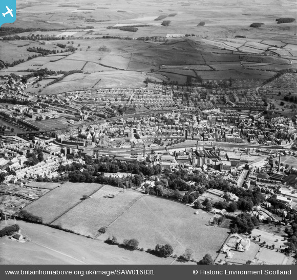
SAW016831 SCOTLAND (1948). Hawick, general view, showing Teviot Road and Commercial Road. An oblique aerial photograph taken facing east.
© Hawlfraint cyfranwyr OpenStreetMap a thrwyddedwyd gan yr OpenStreetMap Foundation. 2025. Trwyddedir y gartograffeg fel CC BY-SA.
Delweddau cyfagos (4)
SAW016831

SPW042483

SAW016834

SPW042486

Manylion
| Pennawd | [SAW016831] Hawick, general view, showing Teviot Road and Commercial Road. An oblique aerial photograph taken facing east. |
| Cyfeirnod | SAW016831 |
| Dyddiad | 1948 |
| Dolen | Canmore Collection item 1269043 |
| Enw lle | |
| Plwyf | HAWICK |
| Ardal | ROXBURGH |
| Gwlad | SCOTLAND |
| Dwyreiniad / Gogleddiad | 350430, 614841 |
| Hydred / Lledred | -2.7832958824467, 55.424940276135 |
| Cyfeirnod Grid Cenedlaethol | NT504148 |
