
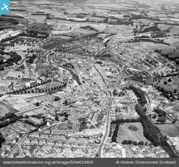
SAW016835 SCOTLAND (1948). Hawick, general view, showing Loan and Teviot Road. An oblique aerial photograph taken facing north-east.
© Hawlfraint cyfranwyr OpenStreetMap a thrwyddedwyd gan yr OpenStreetMap Foundation. 2025. Trwyddedir y gartograffeg fel CC BY-SA.
Delweddau cyfagos (5)
SAW016835

SAW016832

SAW016834

SAW016833

SPW042484

Manylion
| Pennawd | [SAW016835] Hawick, general view, showing Loan and Teviot Road. An oblique aerial photograph taken facing north-east. |
| Cyfeirnod | SAW016835 |
| Dyddiad | 1948 |
| Dolen | Canmore Collection item 1269047 |
| Enw lle | |
| Plwyf | HAWICK |
| Ardal | ROXBURGH |
| Gwlad | SCOTLAND |
| Dwyreiniad / Gogleddiad | 350250, 614551 |
| Hydred / Lledred | -2.7860881454748, 55.422316168599 |
| Cyfeirnod Grid Cenedlaethol | NT503146 |
Pinnau
 redmist |
Sunday 5th of June 2022 11:33:03 PM | |
forostar |
Saturday 5th of October 2019 05:08:19 PM | |
forostar |
Saturday 5th of October 2019 05:05:50 PM | |
forostar |
Saturday 5th of October 2019 05:03:23 PM | |
 Class31 |
Thursday 22nd of November 2012 11:05:18 AM | |
Class31 |
Thursday 22nd of November 2012 11:04:05 AM | |
Class31 |
Thursday 22nd of November 2012 11:02:47 AM | |
Class31 |
Thursday 22nd of November 2012 11:02:27 AM | |
Class31 |
Thursday 22nd of November 2012 11:01:49 AM | |
Class31 |
Thursday 22nd of November 2012 11:01:20 AM | |
Class31 |
Thursday 22nd of November 2012 11:00:18 AM | |
Class31 |
Thursday 22nd of November 2012 10:59:54 AM | |
Class31 |
Thursday 22nd of November 2012 10:59:09 AM |