
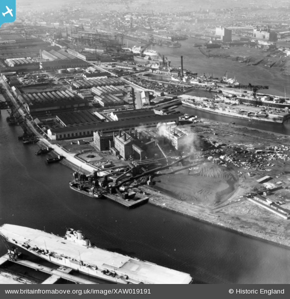
XAW019191 NORTHERN IRELAND (1948). Harbour Power Station, Belfast, Belfast, Northern Ireland, 1948. Oblique aerial photograph taken facing West.
© Hawlfraint cyfranwyr OpenStreetMap a thrwyddedwyd gan yr OpenStreetMap Foundation. 2025. Trwyddedir y gartograffeg fel CC BY-SA.
Delweddau cyfagos (6)
XAW019191

XAW009558

XPW043364

XAW009549

XAW019190

XAW009557

Manylion
| Pennawd | [XAW019191] Harbour Power Station, Belfast, Belfast, Northern Ireland, 1948. Oblique aerial photograph taken facing West. |
| Cyfeirnod | XAW019191 |
| Dyddiad | 25-September-1948 |
| Dolen | |
| Enw lle | BELFAST |
| Plwyf | NORTHERN IRELAND |
| Ardal | |
| Gwlad | NORTHERN IRELAND |
| Dwyreiniad / Gogleddiad | 148494, 531463 |
| Hydred / Lledred | -5.896942, 54.615499 |
| Cyfeirnod Grid Cenedlaethol |
