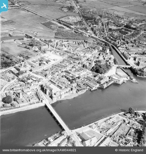
XAW044821 IRELAND (1952). General View, Limerick, Limerick, Ireland, 1952. Oblique aerial photograph taken facing South/East.
© Hawlfraint cyfranwyr OpenStreetMap a thrwyddedwyd gan yr OpenStreetMap Foundation. 2025. Trwyddedir y gartograffeg fel CC BY-SA.
Delweddau cyfagos (6)
Manylion
| Pennawd | [XAW044821] General View, Limerick, Limerick, Ireland, 1952. Oblique aerial photograph taken facing South/East. |
| Cyfeirnod | XAW044821 |
| Dyddiad | 21-July-1952 |
| Dolen | |
| Enw lle | LIMERICK |
| Plwyf | IRELAND |
| Ardal | |
| Gwlad | IRELAND |
| Dwyreiniad / Gogleddiad | -47493, 328542 |
| Hydred / Lledred | -8.622678, 52.669113 |
| Cyfeirnod Grid Cenedlaethol |
Pinnau
 Antoinireland |
Saturday 13th of July 2024 06:30:27 PM | |
 Antoinireland |
Saturday 13th of July 2024 06:28:21 PM | |
 Antoinireland |
Saturday 13th of July 2024 06:22:57 PM | |
 Antoinireland |
Saturday 13th of July 2024 06:22:40 PM | |
 Antoinireland |
Saturday 13th of July 2024 06:22:15 PM | |
 Antoinireland |
Saturday 13th of July 2024 06:21:28 PM |


![[XAW044821] General View, Limerick, Limerick, Ireland, 1952. Oblique aerial photograph taken facing South/East.](http://britainfromabove.org.uk/sites/all/libraries/aerofilms-images/public/100x100/XAW/044/XAW044821.jpg)
![[XAW009596] General View, Limerick, Limerick, Ireland, 1947. Oblique aerial photograph taken facing East.](http://britainfromabove.org.uk/sites/all/libraries/aerofilms-images/public/100x100/XAW/009/XAW009596.jpg)
![[XAW044818] General View, Limerick, Limerick, Ireland, 1952. Oblique aerial photograph taken facing South/East.](http://britainfromabove.org.uk/sites/all/libraries/aerofilms-images/public/100x100/XAW/044/XAW044818.jpg)
![[XAW044820] General View, Limerick, Limerick, Ireland, 1952. Oblique aerial photograph taken facing East.](http://britainfromabove.org.uk/sites/all/libraries/aerofilms-images/public/100x100/XAW/044/XAW044820.jpg)
![[XAW044822] General View, Limerick, Limerick, Ireland, 1952. Oblique aerial photograph taken facing South/West.](http://britainfromabove.org.uk/sites/all/libraries/aerofilms-images/public/100x100/XAW/044/XAW044822.jpg)
![[XAW044811] General View, Limerick, Limerick, Ireland, 1952. Oblique aerial photograph taken facing East.](http://britainfromabove.org.uk/sites/all/libraries/aerofilms-images/public/100x100/XAW/044/XAW044811.jpg)