
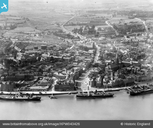
XPW043426 IRELAND (1933). General View, Waterford, Kilkenny, Ireland, 1933. Oblique aerial photograph taken facing South.
© Hawlfraint cyfranwyr OpenStreetMap a thrwyddedwyd gan yr OpenStreetMap Foundation. 2025. Trwyddedir y gartograffeg fel CC BY-SA.
Delweddau cyfagos (7)
XPW043426

XPW042403

XPW043435

XAW018979

XPW043434

XPW043436

XPW042400

Manylion
| Pennawd | [XPW043426] General View, Waterford, Kilkenny, Ireland, 1933. Oblique aerial photograph taken facing South. |
| Cyfeirnod | XPW043426 |
| Dyddiad | 1933 |
| Dolen | |
| Enw lle | WATERFORD |
| Plwyf | IRELAND |
| Ardal | |
| Gwlad | IRELAND |
| Dwyreiniad / Gogleddiad | 51631, 274559 |
| Hydred / Lledred | -7.106935, 52.258546 |
| Cyfeirnod Grid Cenedlaethol |
Pinnau
 ofarrl1960 |
Saturday 2nd of November 2019 09:06:54 PM | |
ofarrl1960 |
Saturday 11th of November 2017 01:32:48 AM | |
ofarrl1960 |
Saturday 11th of November 2017 01:30:15 AM | |
gBr |
Saturday 12th of September 2015 11:00:31 PM |