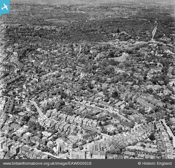
EAW000618 ENGLAND (1946). The residential area to the south of West Heath, Hampstead, 1946
© Copyright OpenStreetMap contributors and licensed by the OpenStreetMap Foundation. 2025. Cartography is licensed as CC BY-SA.
Details
| Title | [EAW000618] The residential area to the south of West Heath, Hampstead, 1946 |
| Reference | EAW000618 |
| Date | 10-May-1946 |
| Link | |
| Place name | HAMPSTEAD |
| Parish | |
| District | |
| Country | ENGLAND |
| Easting / Northing | 525804, 185813 |
| Longitude / Latitude | -0.18510043239867, 51.556676764784 |
| National Grid Reference | TQ258858 |
Pins
Be the first to add a comment to this image!


![[EAW000618] The residential area to the south of West Heath, Hampstead, 1946](http://britainfromabove.org.uk/sites/all/libraries/aerofilms-images/public/100x100/EAW/000/EAW000618.jpg)
![[EPW000813] General view over Hampstead, Hampstead, from the west, 1920](http://britainfromabove.org.uk/sites/all/libraries/aerofilms-images/public/100x100/EPW/000/EPW000813.jpg)
![[EAW014554] The Vale of Health, Hampstead, 1948. This image has been produced from a damaged negative.](http://britainfromabove.org.uk/sites/all/libraries/aerofilms-images/public/100x100/EAW/014/EAW014554.jpg)
![[EAW000616] The residential area to the south of West Heath, Hampstead, 1946](http://britainfromabove.org.uk/sites/all/libraries/aerofilms-images/public/100x100/EAW/000/EAW000616.jpg)