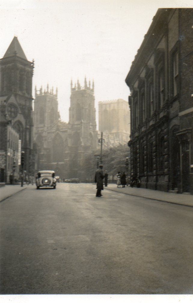
EAW000862 ENGLAND (1946). York Minster and environs, York, 1946
© Copyright OpenStreetMap contributors and licensed by the OpenStreetMap Foundation. 2025. Cartography is licensed as CC BY-SA.
Nearby Images (16)
Details
| Title | [EAW000862] York Minster and environs, York, 1946 |
| Reference | EAW000862 |
| Date | 15-May-1946 |
| Link | |
| Place name | YORK |
| Parish | |
| District | |
| Country | ENGLAND |
| Easting / Northing | 460324, 452229 |
| Longitude / Latitude | -1.080445939515, 53.962425697781 |
| National Grid Reference | SE603522 |
Pins
 Tegels |
Wednesday 18th of October 2017 09:16:19 PM | |
 Sparky |
Friday 18th of August 2017 11:51:00 PM | |
Would love to know more about this scheme. Yes, I can see the gasholder is camouflaged ... |
 Tegels |
Wednesday 18th of October 2017 09:15:24 PM |
 Tegels |
Thursday 2nd of October 2014 09:42:32 PM | |
Otherwise known as York's Klonne gasholder, again with stunning view of the Minster ... |
 Tegels |
Wednesday 18th of October 2017 09:17:29 PM |
 Class31 |
Tuesday 16th of September 2014 11:45:05 AM | |
 connis |
Friday 6th of June 2014 04:13:59 PM | |
 Class31 |
Wednesday 7th of May 2014 08:51:44 AM | |
 Class31 |
Wednesday 7th of May 2014 08:37:35 AM | |
 Alan McFaden |
Monday 16th of December 2013 11:10:26 PM | |
 Alan McFaden |
Monday 16th of December 2013 11:09:56 PM |
User Comment Contributions
 An original snapshot of York taken in June or July 1939. "High Petergate & Bootham Bar " |
 Class31 |
Wednesday 7th of May 2014 08:52:07 AM |
 An original snapshot of York taken in June or July 1939. "Bootham Bar " |
 Class31 |
Wednesday 7th of May 2014 08:37:56 AM |
 An original snapshot of York taken in June or July 1939. " The Minster West Front" |
 Class31 |
Wednesday 7th of May 2014 08:30:14 AM |
 YorkStories |
Saturday 31st of August 2013 11:09:55 AM |


![[EAW000862] York Minster and environs, York, 1946](http://britainfromabove.org.uk/sites/all/libraries/aerofilms-images/public/100x100/EAW/000/EAW000862.jpg)
![[EAW000859] York Minster, Minster Park and the city, York, 1946](http://britainfromabove.org.uk/sites/all/libraries/aerofilms-images/public/100x100/EAW/000/EAW000859.jpg)
![[EAW000861] York Minster, Minster Park and the city, York, 1946](http://britainfromabove.org.uk/sites/all/libraries/aerofilms-images/public/100x100/EAW/000/EAW000861.jpg)
![[EAW009421] York Minster, York, 1947. This image has been produced from a print.](http://britainfromabove.org.uk/sites/all/libraries/aerofilms-images/public/100x100/EAW/009/EAW009421.jpg)
![[EPW016073] York Minster, York, 1926](http://britainfromabove.org.uk/sites/all/libraries/aerofilms-images/public/100x100/EPW/016/EPW016073.jpg)
![[EAW009422] York Minster, York, 1947. This image has been produced from a print.](http://britainfromabove.org.uk/sites/all/libraries/aerofilms-images/public/100x100/EAW/009/EAW009422.jpg)
![[EAW005742] York Minster, York, 1947](http://britainfromabove.org.uk/sites/all/libraries/aerofilms-images/public/100x100/EAW/005/EAW005742.jpg)
![[EAW005743] York Minster, York, 1947](http://britainfromabove.org.uk/sites/all/libraries/aerofilms-images/public/100x100/EAW/005/EAW005743.jpg)
![[EAW049694] York Minster and the city, York, 1953](http://britainfromabove.org.uk/sites/all/libraries/aerofilms-images/public/100x100/EAW/049/EAW049694.jpg)
![[EPW016072] York Minster, York, 1926](http://britainfromabove.org.uk/sites/all/libraries/aerofilms-images/public/100x100/EPW/016/EPW016072.jpg)
![[EAW009420] York Minster, York, 1947. This image has been produced from a print.](http://britainfromabove.org.uk/sites/all/libraries/aerofilms-images/public/100x100/EAW/009/EAW009420.jpg)
![[EAW003656] York Minster and the city, York, from the north-west, 1947](http://britainfromabove.org.uk/sites/all/libraries/aerofilms-images/public/100x100/EAW/003/EAW003656.jpg)
![[EAW049696] York Minster, York, 1953](http://britainfromabove.org.uk/sites/all/libraries/aerofilms-images/public/100x100/EAW/049/EAW049696.jpg)
![[EAW049697] York Minster, York, 1953](http://britainfromabove.org.uk/sites/all/libraries/aerofilms-images/public/100x100/EAW/049/EAW049697.jpg)
![[EAW049695] York Minster and the city, York, 1953](http://britainfromabove.org.uk/sites/all/libraries/aerofilms-images/public/100x100/EAW/049/EAW049695.jpg)
![[EAW000863] York Minster and environs, York, 1946](http://britainfromabove.org.uk/sites/all/libraries/aerofilms-images/public/100x100/EAW/000/EAW000863.jpg)


