
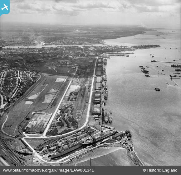
EAW001341 ENGLAND (1946). The New Docks (Western Docks), Southampton, from the north-west, 1946
© Copyright OpenStreetMap contributors and licensed by the OpenStreetMap Foundation. 2025. Cartography is licensed as CC BY-SA.
Nearby Images (4)
EAW001341
, Southampton, from the north-west, 1946")
EAW022294
, Southampton, 1949")
EAW001340
, Southampton, from the north-west, 1946")
EAW001342
, Southampton, from the north-west, 1946")
Details
| Title | [EAW001341] The New Docks (Western Docks), Southampton, from the north-west, 1946 |
| Reference | EAW001341 |
| Date | 28-June-1946 |
| Link | |
| Place name | SOUTHAMPTON |
| Parish | |
| District | |
| Country | ENGLAND |
| Easting / Northing | 440150, 112044 |
| Longitude / Latitude | -1.4289122626961, 50.905917495673 |
| National Grid Reference | SU402120 |
Pins
 redmist |
Wednesday 7th of December 2022 09:29:07 AM | |
redmist |
Monday 5th of December 2022 09:29:57 PM | |
redmist |
Monday 5th of December 2022 09:28:37 PM | |
redmist |
Monday 5th of December 2022 09:28:09 PM | |
redmist |
Monday 5th of December 2022 09:26:13 PM | |
redmist |
Monday 5th of December 2022 09:24:23 PM | |
redmist |
Monday 5th of December 2022 09:13:08 PM | |
ken |
Thursday 16th of July 2015 09:57:34 PM |