
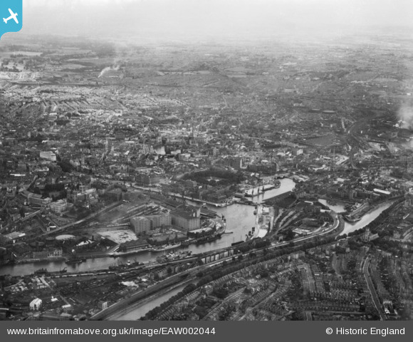
EAW002044 ENGLAND (1946). The Floating Harbour and the city centre, Bristol, from the south-west, 1946. This image has been produced from a print.
© Copyright OpenStreetMap contributors and licensed by the OpenStreetMap Foundation. 2025. Cartography is licensed as CC BY-SA.
Nearby Images (16)
EAW002044

EPW010234

EAW033314

EPW005443

EAW002049

EPW005444

EPW005445

EPW005440

EPW005446

EPW005441

EPW033504

EPW005442

EPW041479

EPW033502

EPW033506

EAW002048

Details
| Title | [EAW002044] The Floating Harbour and the city centre, Bristol, from the south-west, 1946. This image has been produced from a print. |
| Reference | EAW002044 |
| Date | 31-July-1946 |
| Link | |
| Place name | BRISTOL |
| Parish | |
| District | |
| Country | ENGLAND |
| Easting / Northing | 358283, 172268 |
| Longitude / Latitude | -2.6003680923162, 51.447371653736 |
| National Grid Reference | ST583723 |
Pins
 allenb1 |
Tuesday 1st of March 2016 10:39:09 PM | |
allenb1 |
Tuesday 1st of March 2016 10:30:41 PM | |
allenb1 |
Tuesday 1st of March 2016 10:26:56 PM | |
allenb1 |
Tuesday 1st of March 2016 10:22:38 PM | |
allenb1 |
Tuesday 1st of March 2016 10:08:33 PM | |
allenb1 |
Tuesday 1st of March 2016 09:48:57 PM | |
allenb1 |
Tuesday 1st of March 2016 09:41:55 PM | |
allenb1 |
Tuesday 1st of March 2016 09:33:51 PM |