
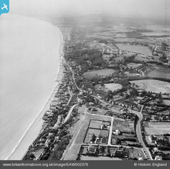
EAW002376 ENGLAND (1946). Sandgate Hill and environs, Folkestone, from the east, 1946
© Copyright OpenStreetMap contributors and licensed by the OpenStreetMap Foundation. 2025. Cartography is licensed as CC BY-SA.
Nearby Images (15)
EAW002376

EPW035412

EAW002377

EPW019045

EPW026113

EAW032832

EAW032834

EAW032835

EAW032836

EAW032833

EAW002860

EPW042871

EPW000585

EAW002858

EPW026117

Details
| Title | [EAW002376] Sandgate Hill and environs, Folkestone, from the east, 1946 |
| Reference | EAW002376 |
| Date | 9-September-1946 |
| Link | |
| Place name | FOLKESTONE |
| Parish | FOLKESTONE |
| District | |
| Country | ENGLAND |
| Easting / Northing | 621224, 135376 |
| Longitude / Latitude | 1.1584002660936, 51.074465843777 |
| National Grid Reference | TR212354 |
Pins
 Paolo |
Friday 31st of July 2015 10:02:15 PM | |
Paolo |
Friday 31st of July 2015 10:01:28 PM | |
Paolo |
Tuesday 8th of July 2014 05:47:50 PM | |
Paolo |
Tuesday 8th of July 2014 05:46:36 PM | |
Paolo |
Tuesday 8th of July 2014 05:44:29 PM | |
Paolo |
Friday 6th of September 2013 12:11:53 PM | |
A house was constructed at the northern end of the trap, which was filled in after the war with scrap metal. Then the owner wondered why the 14 ton stone chimney drove the house into the ground! |
Paolo |
Wednesday 5th of February 2014 09:24:42 PM |
