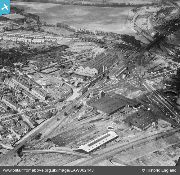
EAW002443 ENGLAND (1946). Stafford Road Engineering (Railway) Works and environs, Wolverhampton, 1946
© Copyright OpenStreetMap contributors and licensed by the OpenStreetMap Foundation. 2025. Cartography is licensed as CC BY-SA.
Nearby Images (12)
Details
| Title | [EAW002443] Stafford Road Engineering (Railway) Works and environs, Wolverhampton, 1946 |
| Reference | EAW002443 |
| Date | 6-September-1946 |
| Link | |
| Place name | WOLVERHAMPTON |
| Parish | |
| District | |
| Country | ENGLAND |
| Easting / Northing | 391288, 300173 |
| Longitude / Latitude | -2.1286396298936, 52.598922848178 |
| National Grid Reference | SJ913002 |


![[EAW002443] Stafford Road Engineering (Railway) Works and environs, Wolverhampton, 1946](http://britainfromabove.org.uk/sites/all/libraries/aerofilms-images/public/100x100/EAW/002/EAW002443.jpg)
![[EAW002444] Stafford Road Engineering (Railway) Works and environs, Wolverhampton, 1946](http://britainfromabove.org.uk/sites/all/libraries/aerofilms-images/public/100x100/EAW/002/EAW002444.jpg)
![[EAW002440] Stafford Road Engineering (Railway) Works, Dunstall Park Racecourse and environs, Wolverhampton, 1946](http://britainfromabove.org.uk/sites/all/libraries/aerofilms-images/public/100x100/EAW/002/EAW002440.jpg)
![[EAW002439] Stafford Road Engineering (Railway) Works and environs, Wolverhampton, 1946](http://britainfromabove.org.uk/sites/all/libraries/aerofilms-images/public/100x100/EAW/002/EAW002439.jpg)
![[EAW002446] Stafford Road Engineering (Railway) Works, Wolverhampton, 1946](http://britainfromabove.org.uk/sites/all/libraries/aerofilms-images/public/100x100/EAW/002/EAW002446.jpg)
![[EAW002451] Stafford Road Engineering (Railway) Works, Wolverhampton, 1946](http://britainfromabove.org.uk/sites/all/libraries/aerofilms-images/public/100x100/EAW/002/EAW002451.jpg)
![[EAW002445] Stafford Road Engineering (Railway) Works and environs, Wolverhampton, 1946](http://britainfromabove.org.uk/sites/all/libraries/aerofilms-images/public/100x100/EAW/002/EAW002445.jpg)
![[EAW002447] Stafford Road Engineering (Railway) Works and environs, Wolverhampton, 1946](http://britainfromabove.org.uk/sites/all/libraries/aerofilms-images/public/100x100/EAW/002/EAW002447.jpg)
![[EAW002450] Stafford Road Engineering (Railway) Works, Dunstall Park Racecourse and environs, Wolverhampton, from the south-east, 1946](http://britainfromabove.org.uk/sites/all/libraries/aerofilms-images/public/100x100/EAW/002/EAW002450.jpg)
![[EAW002449] Stafford Road Engineering (Railway) Works, Dunstall Park Racecourse and environs, Wolverhampton, from the south-east, 1946](http://britainfromabove.org.uk/sites/all/libraries/aerofilms-images/public/100x100/EAW/002/EAW002449.jpg)
![[EAW002441] Stafford Road Engineering (Railway) Works, Wolverhampton, 1946](http://britainfromabove.org.uk/sites/all/libraries/aerofilms-images/public/100x100/EAW/002/EAW002441.jpg)
![[EAW002442] Stafford Road Engineering (Railway) Works, Dunstall Park Racecourse and environs, Wolverhampton, from the south-east, 1946](http://britainfromabove.org.uk/sites/all/libraries/aerofilms-images/public/100x100/EAW/002/EAW002442.jpg)
