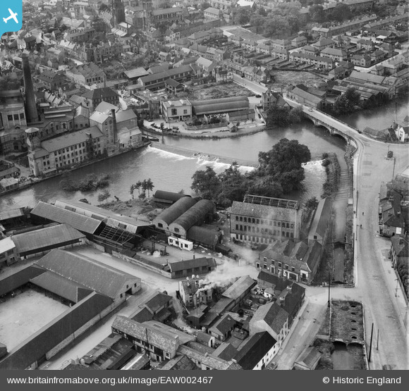
EAW002467 ENGLAND (1946). St Mary's Bridge and nearby industrial buildings, Derby, 1946
© Copyright OpenStreetMap contributors and licensed by the OpenStreetMap Foundation. 2025. Cartography is licensed as CC BY-SA.
Nearby Images (12)
Details
| Title | [EAW002467] St Mary's Bridge and nearby industrial buildings, Derby, 1946 |
| Reference | EAW002467 |
| Date | 6-September-1946 |
| Link | |
| Place name | DERBY |
| Parish | |
| District | |
| Country | ENGLAND |
| Easting / Northing | 435409, 336647 |
| Longitude / Latitude | -1.4732270916581, 52.92574742841 |
| National Grid Reference | SK354366 |
Pins
 Sparky |
Sunday 17th of September 2017 02:57:24 PM | |
 phillrooney |
Wednesday 3rd of September 2014 02:59:31 PM | |
 phillrooney |
Wednesday 3rd of September 2014 02:56:48 PM |


![[EAW002467] St Mary's Bridge and nearby industrial buildings, Derby, 1946](http://britainfromabove.org.uk/sites/all/libraries/aerofilms-images/public/100x100/EAW/002/EAW002467.jpg)
![[EPW055025] St Mary's Goods Yard, works off Stuart Street and the Central Power Station, Derby, 1937](http://britainfromabove.org.uk/sites/all/libraries/aerofilms-images/public/100x100/EPW/055/EPW055025.jpg)
![[EAW002465] St Mary's Bridge and nearby industrial buildings, Derby, 1946](http://britainfromabove.org.uk/sites/all/libraries/aerofilms-images/public/100x100/EAW/002/EAW002465.jpg)
![[EAW002466] The site of the Phoenix Iron Foundry, Derby Silk Mill and environs, Derby, 1946](http://britainfromabove.org.uk/sites/all/libraries/aerofilms-images/public/100x100/EAW/002/EAW002466.jpg)
![[EAW002468] The site of the Phoenix Iron Foundry, Derby Silk Mill and environs, Derby, 1946](http://britainfromabove.org.uk/sites/all/libraries/aerofilms-images/public/100x100/EAW/002/EAW002468.jpg)
![[EPW021119] Corporation Baths and All Saints' Church, Derby, 1928](http://britainfromabove.org.uk/sites/all/libraries/aerofilms-images/public/100x100/EPW/021/EPW021119.jpg)
![[EPW021122] Corporation Power Station and All Saints' Church, Derby, 1928](http://britainfromabove.org.uk/sites/all/libraries/aerofilms-images/public/100x100/EPW/021/EPW021122.jpg)
![[EPW021123] Corporation Power Station and All Saints' Church, Derby, 1928](http://britainfromabove.org.uk/sites/all/libraries/aerofilms-images/public/100x100/EPW/021/EPW021123.jpg)
![[EPW021120] Corporation Power Station, Derby, 1928](http://britainfromabove.org.uk/sites/all/libraries/aerofilms-images/public/100x100/EPW/021/EPW021120.jpg)
![[EPW021121] Corporation Power Station and All Saints' Church, Derby, 1928](http://britainfromabove.org.uk/sites/all/libraries/aerofilms-images/public/100x100/EPW/021/EPW021121.jpg)
![[EAW004660] The city centre, Derby, from the west, 1947](http://britainfromabove.org.uk/sites/all/libraries/aerofilms-images/public/100x100/EAW/004/EAW004660.jpg)
![[EAW004663] The city centre, Derby, from the west, 1947](http://britainfromabove.org.uk/sites/all/libraries/aerofilms-images/public/100x100/EAW/004/EAW004663.jpg)

