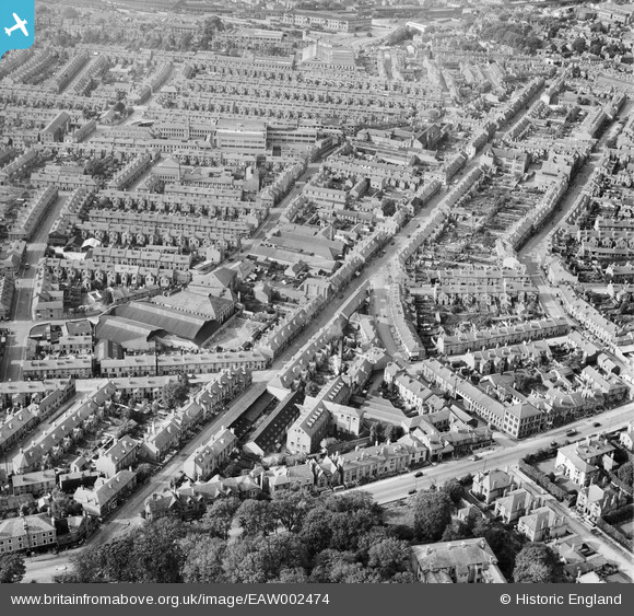
EAW002474 ENGLAND (1946). Ernest Turner Spa Lane Mills and Abbey Street, Derby, 1946
© Copyright OpenStreetMap contributors and licensed by the OpenStreetMap Foundation. 2025. Cartography is licensed as CC BY-SA.
Nearby Images (8)
Details
| Title | [EAW002474] Ernest Turner Spa Lane Mills and Abbey Street, Derby, 1946 |
| Reference | EAW002474 |
| Date | 6-September-1946 |
| Link | |
| Place name | DERBY |
| Parish | |
| District | |
| Country | ENGLAND |
| Easting / Northing | 434820, 335491 |
| Longitude / Latitude | -1.4821131505155, 52.915393542508 |
| National Grid Reference | SK348355 |
Pins
Be the first to add a comment to this image!


![[EAW002474] Ernest Turner Spa Lane Mills and Abbey Street, Derby, 1946](http://britainfromabove.org.uk/sites/all/libraries/aerofilms-images/public/100x100/EAW/002/EAW002474.jpg)
![[EAW002471] Ernest Turner Spa Lane Mills and environs, Derby, 1946](http://britainfromabove.org.uk/sites/all/libraries/aerofilms-images/public/100x100/EAW/002/EAW002471.jpg)
![[EAW002475] Ernest Turner Spa Lane Mills and Abbey Street, Derby, 1946](http://britainfromabove.org.uk/sites/all/libraries/aerofilms-images/public/100x100/EAW/002/EAW002475.jpg)
![[EAW002469] Ernest Turner Spa Lane Mills and environs, Derby, 1946](http://britainfromabove.org.uk/sites/all/libraries/aerofilms-images/public/100x100/EAW/002/EAW002469.jpg)
![[EAW002470] Burton Road at Spa Lane and environs, Derby, 1946](http://britainfromabove.org.uk/sites/all/libraries/aerofilms-images/public/100x100/EAW/002/EAW002470.jpg)
![[EAW002472] Ernest Turner Spa Lane Mills, Burton Road and environs, Derby, 1946](http://britainfromabove.org.uk/sites/all/libraries/aerofilms-images/public/100x100/EAW/002/EAW002472.jpg)
![[EAW002473] Ernest Turner Spa Lane Mills and Burton Road, Derby, 1946](http://britainfromabove.org.uk/sites/all/libraries/aerofilms-images/public/100x100/EAW/002/EAW002473.jpg)
![[EPW055019] The Derby Brick Co Ltd Brickworks, Abbey Street and the city, Derby, from the south-west, 1937](http://britainfromabove.org.uk/sites/all/libraries/aerofilms-images/public/100x100/EPW/055/EPW055019.jpg)