
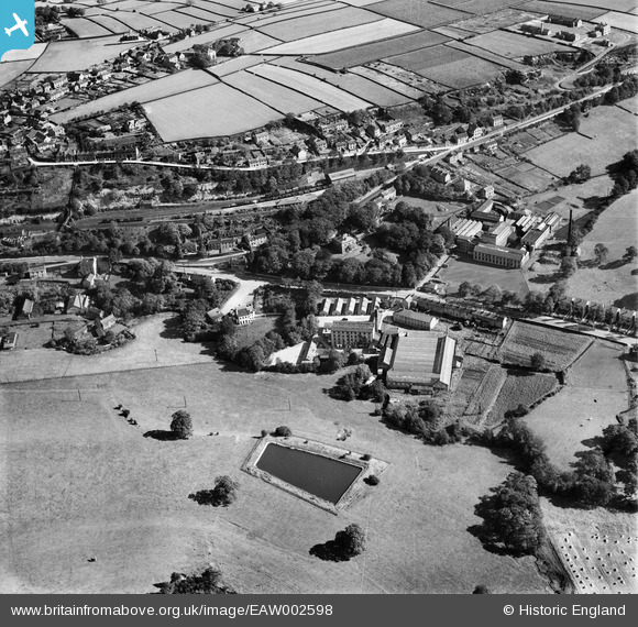
EAW002598 ENGLAND (1946). The Brookfield Woollen Mill and environs, Kirkburton, 1946
© Copyright OpenStreetMap contributors and licensed by the OpenStreetMap Foundation. 2025. Cartography is licensed as CC BY-SA.
Nearby Images (7)
EAW002598

EAW002595

EAW002596

EAW002597

EAW002593

EAW002594

EAW002599

Details
| Title | [EAW002598] The Brookfield Woollen Mill and environs, Kirkburton, 1946 |
| Reference | EAW002598 |
| Date | 16-September-1946 |
| Link | |
| Place name | KIRKBURTON |
| Parish | KIRKBURTON |
| District | |
| Country | ENGLAND |
| Easting / Northing | 419008, 413113 |
| Longitude / Latitude | -1.7126443918768, 53.613984746429 |
| National Grid Reference | SE190131 |
Pins
 Anthony Lockwood |
Wednesday 25th of November 2020 08:25:19 PM | |
redmist |
Saturday 9th of November 2019 11:29:54 PM | |
redmist |
Saturday 9th of November 2019 11:26:16 PM |