
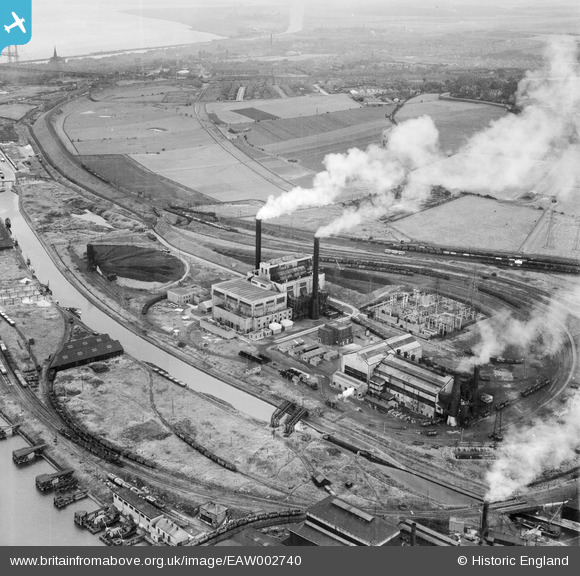
EAW002740 ENGLAND (1946). Percival Lane Power Station, Runcorn, 1946
© Copyright OpenStreetMap contributors and licensed by the OpenStreetMap Foundation. 2025. Cartography is licensed as CC BY-SA.
Nearby Images (16)
EAW002740

EAW005671

EAW005667

EAW002741

EAW005668

EAW005672

EAW002743

EAW005662

EAW002738

EAW002735

EAW002739

EAW002742

EAW016787

EAW005673

EAW002736

EAW005663

Details
| Title | [EAW002740] Percival Lane Power Station, Runcorn, 1946 |
| Reference | EAW002740 |
| Date | 11-September-1946 |
| Link | |
| Place name | RUNCORN |
| Parish | |
| District | |
| Country | ENGLAND |
| Easting / Northing | 349784, 382039 |
| Longitude / Latitude | -2.7541464999437, 53.332606888874 |
| National Grid Reference | SJ498820 |
Pins
 Bottom Yard |
Tuesday 8th of October 2024 04:20:51 PM |