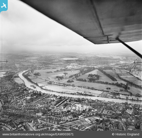
EAW003671 ENGLAND (1947). The River Thames in flood, Hampton Court Park, from the east, 1947
© Copyright OpenStreetMap contributors and licensed by the OpenStreetMap Foundation. 2025. Cartography is licensed as CC BY-SA.
Details
| Title | [EAW003671] The River Thames in flood, Hampton Court Park, from the east, 1947 |
| Reference | EAW003671 |
| Date | 18-March-1947 |
| Link | |
| Place name | HAMPTON COURT PARK |
| Parish | |
| District | |
| Country | ENGLAND |
| Easting / Northing | 517705, 168526 |
| Longitude / Latitude | -0.30764527882027, 51.403039362914 |
| National Grid Reference | TQ177685 |


![[EAW003671] The River Thames in flood, Hampton Court Park, from the east, 1947](http://britainfromabove.org.uk/sites/all/libraries/aerofilms-images/public/100x100/EAW/003/EAW003671.jpg)
![[EPW001727] Kingston upon Thames and Kingston Bridge along the Thames, Kingston upon Thames, 1920](http://britainfromabove.org.uk/sites/all/libraries/aerofilms-images/public/100x100/EPW/001/EPW001727.jpg)
![[EPW049590] The River Thames at Kingston Bridge and environs, Kingston upon Thames, 1936. This image has been produced from a damaged negative.](http://britainfromabove.org.uk/sites/all/libraries/aerofilms-images/public/100x100/EPW/049/EPW049590.jpg)
![[EPW056229] County Hall, Kingston Upon Thames, 1937](http://britainfromabove.org.uk/sites/all/libraries/aerofilms-images/public/100x100/EPW/056/EPW056229.jpg)
