
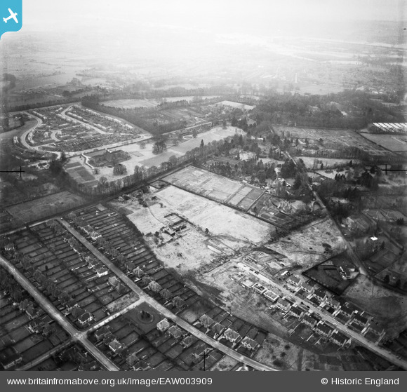
EAW003909 ENGLAND (1947). New housing under construction at Headley Way, Pullens Lane and environs, Headington Hill, 1947
© Copyright OpenStreetMap contributors and licensed by the OpenStreetMap Foundation. 2025. Cartography is licensed as CC BY-SA.
Nearby Images (6)
EAW003909

EAW023202

EAW023200

EAW003910

EAW023201

EPW050487

Details
| Title | [EAW003909] New housing under construction at Headley Way, Pullens Lane and environs, Headington Hill, 1947 |
| Reference | EAW003909 |
| Date | 20-March-1947 |
| Link | |
| Place name | HEADINGTON HILL |
| Parish | |
| District | |
| Country | ENGLAND |
| Easting / Northing | 453639, 206996 |
| Longitude / Latitude | -1.22275875953, 51.75862538802 |
| National Grid Reference | SP536070 |
Pins
Be the first to add a comment to this image!