
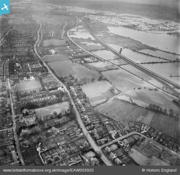
EAW003920 ENGLAND (1947). Woodstock Road and flooding at Port Meadow, Summertown, 1947
© Copyright OpenStreetMap contributors and licensed by the OpenStreetMap Foundation. 2025. Cartography is licensed as CC BY-SA.
Nearby Images (3)
EAW003920

EPW022541

EAW003919

Details
| Title | [EAW003920] Woodstock Road and flooding at Port Meadow, Summertown, 1947 |
| Reference | EAW003920 |
| Date | 20-March-1947 |
| Link | |
| Place name | SUMMERTOWN |
| Parish | |
| District | |
| Country | ENGLAND |
| Easting / Northing | 450263, 209080 |
| Longitude / Latitude | -1.2713717101537, 51.777676652554 |
| National Grid Reference | SP503091 |
Pins
Be the first to add a comment to this image!