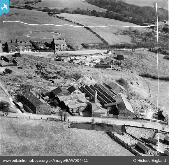
EAW004411 ENGLAND (1947). Wheatfield Iron Works, Bardsley,1947. This image was marked by Aerofilms Ltd for photo editing.
© Copyright OpenStreetMap contributors and licensed by the OpenStreetMap Foundation. 2025. Cartography is licensed as CC BY-SA.
Nearby Images (8)
Details
| Title | [EAW004411] Wheatfield Iron Works, Bardsley,1947. This image was marked by Aerofilms Ltd for photo editing. |
| Reference | EAW004411 |
| Date | 13-April-1947 |
| Link | |
| Place name | BARDSLEY |
| Parish | |
| District | |
| Country | ENGLAND |
| Easting / Northing | 392913, 401632 |
| Longitude / Latitude | -2.1068786950246, 53.511074993535 |
| National Grid Reference | SD929016 |
Pins
 eddief |
Monday 2nd of September 2013 03:44:30 PM | |
 eddief |
Monday 2nd of September 2013 03:43:30 PM | |
 eddief |
Monday 2nd of September 2013 03:42:41 PM | |
 eddief |
Monday 2nd of September 2013 03:42:00 PM | |
 eddief |
Monday 2nd of September 2013 03:41:18 PM | |
 eddief |
Monday 2nd of September 2013 03:38:18 PM |


![[EAW004411] Wheatfield Iron Works, Bardsley,1947. This image was marked by Aerofilms Ltd for photo editing.](http://britainfromabove.org.uk/sites/all/libraries/aerofilms-images/public/100x100/EAW/004/EAW004411.jpg)
![[EAW004410] Wheatfield Iron Works, Bardsley,1947. This image was marked by Aerofilms Ltd for photo editing.](http://britainfromabove.org.uk/sites/all/libraries/aerofilms-images/public/100x100/EAW/004/EAW004410.jpg)
![[EAW004408] Wheatfield Iron Works and environs, Bardsley,1947. This image was marked by Aerofilms Ltd for photo editing.](http://britainfromabove.org.uk/sites/all/libraries/aerofilms-images/public/100x100/EAW/004/EAW004408.jpg)
![[EAW004407] Wheatfield Iron Works, Bardsley, 1947. This image was marked by Aerofilms Ltd for photo editing.](http://britainfromabove.org.uk/sites/all/libraries/aerofilms-images/public/100x100/EAW/004/EAW004407.jpg)
![[EAW004409] Wheatfield Iron Works, Bardsley,1947. This image was marked by Aerofilms Ltd for photo editing.](http://britainfromabove.org.uk/sites/all/libraries/aerofilms-images/public/100x100/EAW/004/EAW004409.jpg)
![[EAW004412] Wheatfield Iron Works, Bardsley,1947. This image was marked by Aerofilms Ltd for photo editing.](http://britainfromabove.org.uk/sites/all/libraries/aerofilms-images/public/100x100/EAW/004/EAW004412.jpg)
![[EAW004413] Wheatfield Iron Works, Bardsley, 1947. This image has been produced from a print marked by Aerofilms Ltd for photo editing.](http://britainfromabove.org.uk/sites/all/libraries/aerofilms-images/public/100x100/EAW/004/EAW004413.jpg)
![[EPW032254] The Bardsley Vale Mills and Bardsley Bridge, Bardsley, 1930](http://britainfromabove.org.uk/sites/all/libraries/aerofilms-images/public/100x100/EPW/032/EPW032254.jpg)