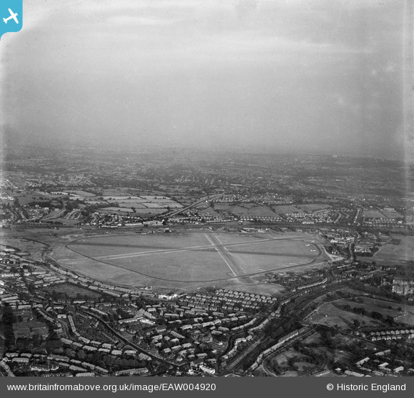
EAW004920 ENGLAND (1947). RAF Hendon airfield, Hendon, from the west, 1947
© Copyright OpenStreetMap contributors and licensed by the OpenStreetMap Foundation. 2025. Cartography is licensed as CC BY-SA.
Nearby Images (6)
Details
| Title | [EAW004920] RAF Hendon airfield, Hendon, from the west, 1947 |
| Reference | EAW004920 |
| Date | April-1947 |
| Link | |
| Place name | HENDON |
| Parish | |
| District | |
| Country | ENGLAND |
| Easting / Northing | 520993, 190670 |
| Longitude / Latitude | -0.25279674395197, 51.601385113931 |
| National Grid Reference | TQ210907 |
Pins
 Matt Aldred edob.mattaldred.com |
Monday 10th of April 2023 05:14:46 PM | |
 Matt Aldred edob.mattaldred.com |
Monday 10th of April 2023 05:14:28 PM |


![[EAW004920] RAF Hendon airfield, Hendon, from the west, 1947](http://britainfromabove.org.uk/sites/all/libraries/aerofilms-images/public/100x100/EAW/004/EAW004920.jpg)
![[EPW019311] New housing next to the London Aerodrome, Burnt Oak, from the east, 1927](http://britainfromabove.org.uk/sites/all/libraries/aerofilms-images/public/100x100/EPW/019/EPW019311.jpg)
![[EPW019312] New housing next to the London Aerodrome, Burnt Oak, from the east, 1927](http://britainfromabove.org.uk/sites/all/libraries/aerofilms-images/public/100x100/EPW/019/EPW019312.jpg)
![[EPW015980] Hendon, aircraft assembled for the RAF Pageant, 1926. This image has been produced from a copy-negative.](http://britainfromabove.org.uk/sites/all/libraries/aerofilms-images/public/100x100/EPW/015/EPW015980.jpg)
![[EPW017588] Gloucester Grove and environs under construction, Burnt Oak, from the south-east, 1927](http://britainfromabove.org.uk/sites/all/libraries/aerofilms-images/public/100x100/EPW/017/EPW017588.jpg)
![[EPW005047] The Packard Car and Lorry Depot at RAF Hendon, Hendon, 1920](http://britainfromabove.org.uk/sites/all/libraries/aerofilms-images/public/100x100/EPW/005/EPW005047.jpg)