
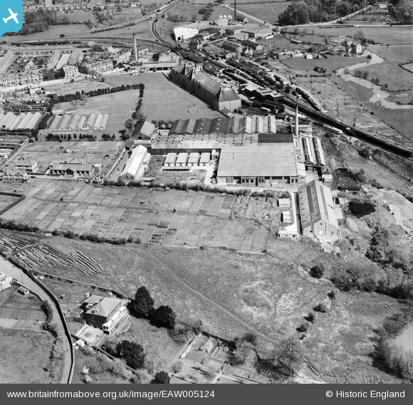
EAW005124 ENGLAND (1947). The Butler and Tanner Ltd Printing Works, Frome, 1947
© Copyright OpenStreetMap contributors and licensed by the OpenStreetMap Foundation. 2025. Cartography is licensed as CC BY-SA.
Nearby Images (11)
EAW005124

EPW033211

EAW005122

EAW005120

EAW005118

EAW005123

EAW005119

EAW005117

EAW005121

EAW005114

EAW005116

Details
| Title | [EAW005124] The Butler and Tanner Ltd Printing Works, Frome, 1947 |
| Reference | EAW005124 |
| Date | 7-September-1947 |
| Link | |
| Place name | FROME |
| Parish | FROME |
| District | |
| Country | ENGLAND |
| Easting / Northing | 378253, 147326 |
| Longitude / Latitude | -2.3114539844677, 51.224196965016 |
| National Grid Reference | ST783473 |
Pins
 Class31 |
Monday 20th of October 2014 10:30:20 PM | |
 |
Class31 |
Monday 20th of October 2014 05:47:00 PM |
 cptpies |
Tuesday 17th of December 2013 01:31:00 PM | |
totoro |
Monday 7th of October 2013 10:44:06 PM | |
totoro |
Monday 7th of October 2013 10:43:15 PM | |
totoro |
Monday 7th of October 2013 10:41:47 PM | |
totoro |
Monday 7th of October 2013 10:41:22 PM | |
totoro |
Monday 7th of October 2013 10:38:39 PM | |
totoro |
Monday 7th of October 2013 10:37:28 PM | |
totoro |
Monday 7th of October 2013 10:35:57 PM | |
totoro |
Monday 7th of October 2013 10:33:16 PM | |
totoro |
Monday 7th of October 2013 10:20:13 PM | |
totoro |
Monday 7th of October 2013 10:19:17 PM |


