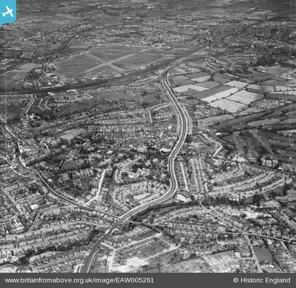
EAW005261 ENGLAND (1947). The Great North Way, Hendon, from the south-east, 1947
© Copyright OpenStreetMap contributors and licensed by the OpenStreetMap Foundation. 2025. Cartography is licensed as CC BY-SA.
Details
| Title | [EAW005261] The Great North Way, Hendon, from the south-east, 1947 |
| Reference | EAW005261 |
| Date | 29-April-1947 |
| Link | |
| Place name | HENDON |
| Parish | |
| District | |
| Country | ENGLAND |
| Easting / Northing | 523802, 189772 |
| Longitude / Latitude | -0.21257126735474, 51.592703333947 |
| National Grid Reference | TQ238898 |
Pins
 Matt Aldred edob.mattaldred.com |
Monday 10th of April 2023 05:41:55 PM | |
 Class31 |
Saturday 22nd of March 2014 06:01:31 PM | |
 Class31 |
Saturday 22nd of March 2014 05:56:21 PM | |
 Class31 |
Saturday 22nd of March 2014 05:54:32 PM | |
 Class31 |
Saturday 22nd of March 2014 05:47:11 PM |


![[EAW005261] The Great North Way, Hendon, from the south-east, 1947](http://britainfromabove.org.uk/sites/all/libraries/aerofilms-images/public/100x100/EAW/005/EAW005261.jpg)
![[EAW005260] The Great North Way, Hendon, from the south-east, 1947](http://britainfromabove.org.uk/sites/all/libraries/aerofilms-images/public/100x100/EAW/005/EAW005260.jpg)
![[EAW004487] The Great North Way looking towards Hendon Aerodrome, Hendon, from the south-east, 1947. This image was marked by Aerofilms Ltd for photo editing.](http://britainfromabove.org.uk/sites/all/libraries/aerofilms-images/public/100x100/EAW/004/EAW004487.jpg)
![[EAW004485] The Great North Way looking towards Hendon Aerodrome, Hendon, from the south-east, 1947. This image was marked by Aerofilms Ltd for photo editing.](http://britainfromabove.org.uk/sites/all/libraries/aerofilms-images/public/100x100/EAW/004/EAW004485.jpg)