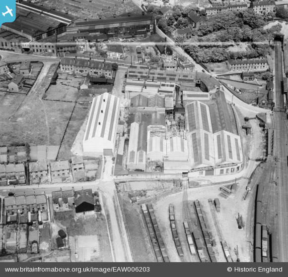
EAW006203 ENGLAND (1947). Prospect Iron Works, Lockwood, 1947. This image was marked by Aerofilms Ltd for photo editing.
© Copyright OpenStreetMap contributors and licensed by the OpenStreetMap Foundation. 2024. Cartography is licensed as CC BY-SA.
Nearby Images (23)
Details
| Title | [EAW006203] Prospect Iron Works, Lockwood, 1947. This image was marked by Aerofilms Ltd for photo editing. |
| Reference | EAW006203 |
| Date | 25-May-1947 |
| Link | |
| Place name | LOCKWOOD |
| Parish | |
| District | |
| Country | ENGLAND |
| Easting / Northing | 413182, 415299 |
| Longitude / Latitude | -1.8006263090314, 53.63381422793 |
| National Grid Reference | SE132153 |
Pins
Be the first to add a comment to this image!


![[EAW006203] Prospect Iron Works, Lockwood, 1947. This image was marked by Aerofilms Ltd for photo editing.](http://britainfromabove.org.uk/sites/all/libraries/aerofilms-images/public/100x100/EAW/006/EAW006203.jpg)
![[EAW006202] Prospect Iron Works, Lockwood, 1947. This image was marked by Aerofilms Ltd for photo editing.](http://britainfromabove.org.uk/sites/all/libraries/aerofilms-images/public/100x100/EAW/006/EAW006202.jpg)
![[EAW044174] The William Whiteley and Sons Works alongside the J. Charlesworth Foundry, Lockwood, 1952. This image was marked by Aerofilms Ltd for photo editing.](http://britainfromabove.org.uk/sites/all/libraries/aerofilms-images/public/100x100/EAW/044/EAW044174.jpg)
![[EAW006205] Prospect Iron Works, Lockwood, 1947. This image was marked by Aerofilms Ltd for photo editing.](http://britainfromabove.org.uk/sites/all/libraries/aerofilms-images/public/100x100/EAW/006/EAW006205.jpg)
![[EAW006207] Prospect Iron Works, Lockwood, 1947. This image was marked by Aerofilms Ltd for photo editing.](http://britainfromabove.org.uk/sites/all/libraries/aerofilms-images/public/100x100/EAW/006/EAW006207.jpg)
![[EAW006199] Prospect Iron Works, Lockwood, 1947. This image was marked by Aerofilms Ltd for photo editing.](http://britainfromabove.org.uk/sites/all/libraries/aerofilms-images/public/100x100/EAW/006/EAW006199.jpg)
![[EAW006204] Prospect Iron Works, Lockwood, 1947. This image was marked by Aerofilms Ltd for photo editing.](http://britainfromabove.org.uk/sites/all/libraries/aerofilms-images/public/100x100/EAW/006/EAW006204.jpg)
![[EAW006208] Prospect Iron Works, Lockwood, 1947. This image was marked by Aerofilms Ltd for photo editing.](http://britainfromabove.org.uk/sites/all/libraries/aerofilms-images/public/100x100/EAW/006/EAW006208.jpg)
![[EAW006198] Prospect Iron Works, Lockwood, 1947. This image was marked by Aerofilms Ltd for photo editing.](http://britainfromabove.org.uk/sites/all/libraries/aerofilms-images/public/100x100/EAW/006/EAW006198.jpg)
![[EAW006201] Prospect Iron Works, Lockwood, 1947. This image was marked by Aerofilms Ltd for photo editing.](http://britainfromabove.org.uk/sites/all/libraries/aerofilms-images/public/100x100/EAW/006/EAW006201.jpg)
![[EAW044175] The William Whiteley and Sons Works alongside the J. Charlesworth Foundry, Lockwood, 1952. This image was marked by Aerofilms Ltd for photo editing.](http://britainfromabove.org.uk/sites/all/libraries/aerofilms-images/public/100x100/EAW/044/EAW044175.jpg)
![[EAW044177] The William Whiteley and Sons Works alongside the J. Charlesworth Foundry, Lockwood, 1952. This image was marked by Aerofilms Ltd for photo editing.](http://britainfromabove.org.uk/sites/all/libraries/aerofilms-images/public/100x100/EAW/044/EAW044177.jpg)
![[EAW044170] The William Whiteley and Sons Works alongside the J. Charlesworth Foundry, Lockwood, 1952. This image was marked by Aerofilms Ltd for photo editing.](http://britainfromabove.org.uk/sites/all/libraries/aerofilms-images/public/100x100/EAW/044/EAW044170.jpg)
![[EAW006206] Prospect Iron Works, Lockwood, 1947. This image was marked by Aerofilms Ltd for photo editing.](http://britainfromabove.org.uk/sites/all/libraries/aerofilms-images/public/100x100/EAW/006/EAW006206.jpg)
![[EAW044173] The William Whiteley and Sons Works alongside the J. Charlesworth Foundry, Lockwood, 1952. This image was marked by Aerofilms Ltd for photo editing.](http://britainfromabove.org.uk/sites/all/libraries/aerofilms-images/public/100x100/EAW/044/EAW044173.jpg)
![[EAW006200] Prospect Iron Works, Lockwood, 1947. This image was marked by Aerofilms Ltd for photo editing.](http://britainfromabove.org.uk/sites/all/libraries/aerofilms-images/public/100x100/EAW/006/EAW006200.jpg)
![[EAW044172] The William Whiteley and Sons Works alongside the J. Charlesworth Foundry and Walpole Road, Lockwood, 1952. This image was marked by Aerofilms Ltd for photo editing.](http://britainfromabove.org.uk/sites/all/libraries/aerofilms-images/public/100x100/EAW/044/EAW044172.jpg)
![[EAW044171] The William Whiteley and Sons Works alongside the J. Charlesworth Foundry and environs, Lockwood, 1952. This image was marked by Aerofilms Ltd for photo editing.](http://britainfromabove.org.uk/sites/all/libraries/aerofilms-images/public/100x100/EAW/044/EAW044171.jpg)
![[EAW044176] The William Whiteley and Sons Works alongside the J. Charlesworth Foundry and environs, Lockwood, 1952. This image was marked by Aerofilms Ltd for photo editing.](http://britainfromabove.org.uk/sites/all/libraries/aerofilms-images/public/100x100/EAW/044/EAW044176.jpg)
![[EPW022877] The Park Gear Works and St Barnabas's Church, Crosland Moor, 1928](http://britainfromabove.org.uk/sites/all/libraries/aerofilms-images/public/100x100/EPW/022/EPW022877.jpg)
![[EPW022878] The Park Gear Works and St Barnabas's Church, Crosland Moor, 1928](http://britainfromabove.org.uk/sites/all/libraries/aerofilms-images/public/100x100/EPW/022/EPW022878.jpg)
![[EPW022876] The Park Gear Works and St Barnabas's Church, Crosland Moor, 1928](http://britainfromabove.org.uk/sites/all/libraries/aerofilms-images/public/100x100/EPW/022/EPW022876.jpg)
![[EPW022875] The Park Gear Works and St Barnabas's Church, Crosland Moor, 1928](http://britainfromabove.org.uk/sites/all/libraries/aerofilms-images/public/100x100/EPW/022/EPW022875.jpg)