
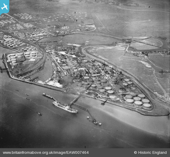
EAW007464 ENGLAND (1947). Part of the Coryton Oil Refinery complex, Coryton, from the south-east, 1947
© Copyright OpenStreetMap contributors and licensed by the OpenStreetMap Foundation. 2025. Cartography is licensed as CC BY-SA.
Nearby Images (8)
EAW007464

EAW007462

EAW007457

EAW007461

EAW007451

EAW007456

EAW047430

EAW043879

Details
| Title | [EAW007464] Part of the Coryton Oil Refinery complex, Coryton, from the south-east, 1947 |
| Reference | EAW007464 |
| Date | 25-June-1947 |
| Link | |
| Place name | CORYTON |
| Parish | |
| District | |
| Country | ENGLAND |
| Easting / Northing | 574701, 181688 |
| Longitude / Latitude | 0.51763032813023, 51.506595953701 |
| National Grid Reference | TQ747817 |
Pins
 cptpies |
Tuesday 10th of October 2017 03:56:50 PM |