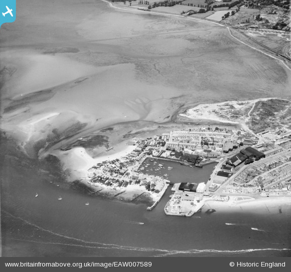
EAW007589 ENGLAND (1947). Exmouth Dock and Cockle Sand, Exmouth, 1947
© Copyright OpenStreetMap contributors and licensed by the OpenStreetMap Foundation. 2025. Cartography is licensed as CC BY-SA.
Nearby Images (8)
Details
| Title | [EAW007589] Exmouth Dock and Cockle Sand, Exmouth, 1947 |
| Reference | EAW007589 |
| Date | 26-June-1947 |
| Link | |
| Place name | EXMOUTH |
| Parish | EXMOUTH |
| District | |
| Country | ENGLAND |
| Easting / Northing | 299366, 80972 |
| Longitude / Latitude | -3.4227053539112, 50.619177454035 |
| National Grid Reference | SX994810 |
Pins
 redmist |
Thursday 12th of January 2023 08:32:02 PM | |
 redmist |
Wednesday 11th of January 2023 10:58:36 PM | |
 redmist |
Wednesday 11th of January 2023 10:55:54 PM | |
 redmist |
Wednesday 11th of January 2023 10:47:52 PM | |
 Matt Aldred edob.mattaldred.com |
Friday 12th of March 2021 12:39:24 AM | |
 cptpies |
Tuesday 10th of October 2017 09:00:45 AM | |
 Sparky |
Sunday 8th of October 2017 05:10:35 PM |


![[EAW007589] Exmouth Dock and Cockle Sand, Exmouth, 1947](http://britainfromabove.org.uk/sites/all/libraries/aerofilms-images/public/100x100/EAW/007/EAW007589.jpg)
![[EPW033463] The Point, Cockle Sand, the town and surrounding countryside, Exmouth, from the west, 1930](http://britainfromabove.org.uk/sites/all/libraries/aerofilms-images/public/100x100/EPW/033/EPW033463.jpg)
![[EPW023666] The Dock, Exmouth, 1928.](http://britainfromabove.org.uk/sites/all/libraries/aerofilms-images/public/100x100/EPW/023/EPW023666.jpg)
![[EPW033465] The Point, Exmouth, 1930](http://britainfromabove.org.uk/sites/all/libraries/aerofilms-images/public/100x100/EPW/033/EPW033465.jpg)
![[EPW033462] The Dock and Pier at The Point, Exmouth, 1930](http://britainfromabove.org.uk/sites/all/libraries/aerofilms-images/public/100x100/EPW/033/EPW033462.jpg)
![[EAW051152] Exmouth Dock and The Point, Exmouth, 1953](http://britainfromabove.org.uk/sites/all/libraries/aerofilms-images/public/100x100/EAW/051/EAW051152.jpg)
![[EAW051153] Exmouth Dock, The Point and environs, Exmouth, 1953](http://britainfromabove.org.uk/sites/all/libraries/aerofilms-images/public/100x100/EAW/051/EAW051153.jpg)
![[EPW039693] The docks and environs, Exmouth, 1932](http://britainfromabove.org.uk/sites/all/libraries/aerofilms-images/public/100x100/EPW/039/EPW039693.jpg)