
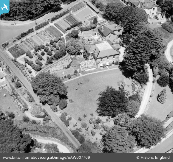
EAW007769 ENGLAND (1947). Warberry Court, Torquay, 1947
© Copyright OpenStreetMap contributors and licensed by the OpenStreetMap Foundation. 2025. Cartography is licensed as CC BY-SA.
Nearby Images (13)
EAW007769

EAW007767

EAW007764

EAW007766

EAW007763

EAW007765

EAW007768

EAW007762

EAW014980

EAW014979

EAW014983

EAW014982

EAW014981

Details
| Title | [EAW007769] Warberry Court, Torquay, 1947 |
| Reference | EAW007769 |
| Date | 22-June-1947 |
| Link | |
| Place name | TORQUAY |
| Parish | |
| District | |
| Country | ENGLAND |
| Easting / Northing | 292561, 64048 |
| Longitude / Latitude | -3.5139950404382, 50.465802396899 |
| National Grid Reference | SX926640 |
Pins
Be the first to add a comment to this image!