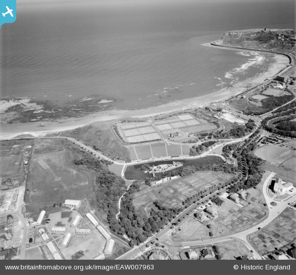
EAW007963 ENGLAND (1947). Northstead Manor Gardens and the Open Air Theatre, Scarborough, 1947
© Copyright OpenStreetMap contributors and licensed by the OpenStreetMap Foundation. 2025. Cartography is licensed as CC BY-SA.
Nearby Images (5)
Details
| Title | [EAW007963] Northstead Manor Gardens and the Open Air Theatre, Scarborough, 1947 |
| Reference | EAW007963 |
| Date | 26-June-1947 |
| Link | |
| Place name | SCARBOROUGH |
| Parish | |
| District | |
| Country | ENGLAND |
| Easting / Northing | 503526, 489942 |
| Longitude / Latitude | -0.40918087438722, 54.294437099896 |
| National Grid Reference | TA035899 |


![[EAW007963] Northstead Manor Gardens and the Open Air Theatre, Scarborough, 1947](http://britainfromabove.org.uk/sites/all/libraries/aerofilms-images/public/100x100/EAW/007/EAW007963.jpg)
![[EAW007962] Northstead Manor Gardens and the Open Air Theatre, Scarborough, 1947](http://britainfromabove.org.uk/sites/all/libraries/aerofilms-images/public/100x100/EAW/007/EAW007962.jpg)
![[EAW007969] Northstead Manor Gardens, Scarborough, 1947](http://britainfromabove.org.uk/sites/all/libraries/aerofilms-images/public/100x100/EAW/007/EAW007969.jpg)
![[EAW007961] Northstead and the headland, Scarborough, from the north-west, 1947](http://britainfromabove.org.uk/sites/all/libraries/aerofilms-images/public/100x100/EAW/007/EAW007961.jpg)
![[EAW007960] Northstead Manor Gardens, Alexandra Gardens, Peasholm Park and the headland, Scarborough, from the north-west, 1947](http://britainfromabove.org.uk/sites/all/libraries/aerofilms-images/public/100x100/EAW/007/EAW007960.jpg)
