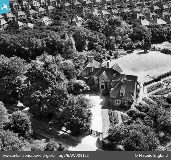
EAW008122 ENGLAND (1947). A private house at Ash Green, Loughton, 1947
© Copyright OpenStreetMap contributors and licensed by the OpenStreetMap Foundation. 2025. Cartography is licensed as CC BY-SA.
Nearby Images (8)
Details
| Title | [EAW008122] A private house at Ash Green, Loughton, 1947 |
| Reference | EAW008122 |
| Date | 12-July-1947 |
| Link | |
| Place name | LOUGHTON |
| Parish | LOUGHTON |
| District | |
| Country | ENGLAND |
| Easting / Northing | 542680, 197295 |
| Longitude / Latitude | 0.062873030830144, 51.655843596248 |
| National Grid Reference | TQ427973 |


![[EAW008122] A private house at Ash Green, Loughton, 1947](http://britainfromabove.org.uk/sites/all/libraries/aerofilms-images/public/100x100/EAW/008/EAW008122.jpg)
![[EAW008124] A private house at Ash Green, Loughton, 1947](http://britainfromabove.org.uk/sites/all/libraries/aerofilms-images/public/100x100/EAW/008/EAW008124.jpg)
![[EAW008117] A private house at Ash Green, Loughton, 1947](http://britainfromabove.org.uk/sites/all/libraries/aerofilms-images/public/100x100/EAW/008/EAW008117.jpg)
![[EAW008119] A private house at Ash Green, Loughton, 1947](http://britainfromabove.org.uk/sites/all/libraries/aerofilms-images/public/100x100/EAW/008/EAW008119.jpg)
![[EAW008118] A private house at Ash Green, Loughton, 1947](http://britainfromabove.org.uk/sites/all/libraries/aerofilms-images/public/100x100/EAW/008/EAW008118.jpg)
![[EAW008121] A private house at Ash Green, Loughton, 1947](http://britainfromabove.org.uk/sites/all/libraries/aerofilms-images/public/100x100/EAW/008/EAW008121.jpg)
![[EAW008123] A private house at Ash Green, Loughton, 1947](http://britainfromabove.org.uk/sites/all/libraries/aerofilms-images/public/100x100/EAW/008/EAW008123.jpg)
![[EAW008120] A private house at Ash Green, Loughton, 1947](http://britainfromabove.org.uk/sites/all/libraries/aerofilms-images/public/100x100/EAW/008/EAW008120.jpg)
