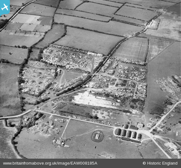
EAW008185A ENGLAND (1947). Piles of scrap metal at RAF Pulham, Rushall, 1947
© Copyright OpenStreetMap contributors and licensed by the OpenStreetMap Foundation. 2025. Cartography is licensed as CC BY-SA.
Nearby Images (8)
Details
| Title | [EAW008185A] Piles of scrap metal at RAF Pulham, Rushall, 1947 |
| Reference | EAW008185A |
| Date | 12-July-1947 |
| Link | |
| Place name | RUSHALL |
| Parish | DICKLEBURGH AND RUSHALL |
| District | |
| Country | ENGLAND |
| Easting / Northing | 619569, 283110 |
| Longitude / Latitude | 1.2280559419611, 52.401497769069 |
| National Grid Reference | TM196831 |
Pins
Be the first to add a comment to this image!


![[EAW008185A] Piles of scrap metal at RAF Pulham, Rushall, 1947](http://britainfromabove.org.uk/sites/all/libraries/aerofilms-images/public/100x100/EAW/008/EAW008185A.jpg)
![[EAW008190] Piles of scrap metal at RAF Pulham, Rushall, 1947](http://britainfromabove.org.uk/sites/all/libraries/aerofilms-images/public/100x100/EAW/008/EAW008190.jpg)
![[EAW008189] Piles of scrap metal at RAF Pulham, Rushall, 1947](http://britainfromabove.org.uk/sites/all/libraries/aerofilms-images/public/100x100/EAW/008/EAW008189.jpg)
![[EAW008186] Piles of scrap metal at RAF Pulham, Rushall, 1947](http://britainfromabove.org.uk/sites/all/libraries/aerofilms-images/public/100x100/EAW/008/EAW008186.jpg)
![[EAW008185] Piles of scrap metal at RAF Pulham, Rushall, 1947](http://britainfromabove.org.uk/sites/all/libraries/aerofilms-images/public/100x100/EAW/008/EAW008185.jpg)
![[EAW008191] Piles of scrap metal and camouflaged airship shed at RAF Pulham, Rushall, 1947](http://britainfromabove.org.uk/sites/all/libraries/aerofilms-images/public/100x100/EAW/008/EAW008191.jpg)
![[EAW008188] Piles of scrap metal at RAF Pulham, Rushall, 1947](http://britainfromabove.org.uk/sites/all/libraries/aerofilms-images/public/100x100/EAW/008/EAW008188.jpg)
![[EAW008187] Piles of scrap metal at RAF Pulham, Rushall, 1947](http://britainfromabove.org.uk/sites/all/libraries/aerofilms-images/public/100x100/EAW/008/EAW008187.jpg)