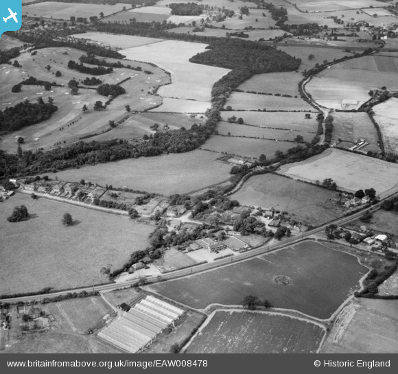
EAW008478 ENGLAND (1947). The hamlet, Bell Bar, 1947
© Copyright OpenStreetMap contributors and licensed by the OpenStreetMap Foundation. 2025. Cartography is licensed as CC BY-SA.
Details
| Title | [EAW008478] The hamlet, Bell Bar, 1947 |
| Reference | EAW008478 |
| Date | 31-July-1947 |
| Link | |
| Place name | BELL BAR |
| Parish | NORTH MYMMS |
| District | |
| Country | ENGLAND |
| Easting / Northing | 525159, 205200 |
| Longitude / Latitude | -0.18746373890168, 51.731066741277 |
| National Grid Reference | TL252052 |
Pins
 Ray Flack |
Wednesday 17th of September 2014 12:59:21 PM | |
 Ray Flack |
Wednesday 17th of September 2014 12:58:52 PM | |
 Ray Flack |
Wednesday 17th of September 2014 12:57:50 PM | |
 Ray Flack |
Wednesday 17th of September 2014 12:57:29 PM | |
 Ray Flack |
Wednesday 17th of September 2014 12:57:10 PM |


![[EAW008478] The hamlet, Bell Bar, 1947](http://britainfromabove.org.uk/sites/all/libraries/aerofilms-images/public/100x100/EAW/008/EAW008478.jpg)
![[EAW008460] Bell Lane, The Legg and Brookmans Park Golf Course, Bell Bar, 1947](http://britainfromabove.org.uk/sites/all/libraries/aerofilms-images/public/100x100/EAW/008/EAW008460.jpg)
![[EAW008477] Bell Lane and Brookmans Park Golf Course, Brookmans Park, 1947](http://britainfromabove.org.uk/sites/all/libraries/aerofilms-images/public/100x100/EAW/008/EAW008477.jpg)
![[EAW008461] Brookmans Park Golf Course, Brookmans Park, 1947](http://britainfromabove.org.uk/sites/all/libraries/aerofilms-images/public/100x100/EAW/008/EAW008461.jpg)