
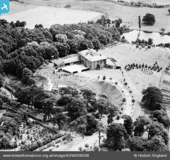
EAW008598 ENGLAND (1947). Delamere Manor and environs, Cuddington, 1947
© Copyright OpenStreetMap contributors and licensed by the OpenStreetMap Foundation. 2025. Cartography is licensed as CC BY-SA.
Nearby Images (10)
EAW008598

EAW008597

EAW008596

EAW008595

EAW008599

EAW008592

EAW008594

EAW008593

EAW008600

EAW008591

Details
| Title | [EAW008598] Delamere Manor and environs, Cuddington, 1947 |
| Reference | EAW008598 |
| Date | 1-August-1947 |
| Link | |
| Place name | CUDDINGTON |
| Parish | CUDDINGTON |
| District | |
| Country | ENGLAND |
| Easting / Northing | 358403, 371264 |
| Longitude / Latitude | -2.6233040734112, 53.236495515727 |
| National Grid Reference | SJ584713 |
Pins
Be the first to add a comment to this image!