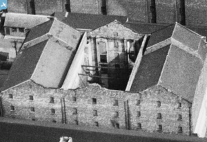
EAW008680 ENGLAND (1947). The Harland and Wolff Shipbuilding and Engineering Works and environs, Bootle, 1947
© Copyright OpenStreetMap contributors and licensed by the OpenStreetMap Foundation. 2025. Cartography is licensed as CC BY-SA.
Nearby Images (10)
Details
| Title | [EAW008680] The Harland and Wolff Shipbuilding and Engineering Works and environs, Bootle, 1947 |
| Reference | EAW008680 |
| Date | 1-August-1947 |
| Link | |
| Place name | BOOTLE |
| Parish | |
| District | |
| Country | ENGLAND |
| Easting / Northing | 333706, 394313 |
| Longitude / Latitude | -2.9981489403075, 53.441158791169 |
| National Grid Reference | SJ337943 |
Pins
 Davemat |
Friday 31st of March 2017 05:09:04 PM | |
 Davemat |
Friday 31st of March 2017 04:59:20 PM | |
 Davemat |
Friday 31st of March 2017 04:57:38 PM | |
 Davemat |
Friday 31st of March 2017 04:54:46 PM | |
 Billy Turner |
Monday 9th of January 2017 06:40:38 PM | |
 Billy Turner |
Monday 9th of January 2017 06:39:05 PM | |
 Billy Turner |
Monday 9th of January 2017 06:37:18 PM |


![[EAW008680] The Harland and Wolff Shipbuilding and Engineering Works and environs, Bootle, 1947](http://britainfromabove.org.uk/sites/all/libraries/aerofilms-images/public/100x100/EAW/008/EAW008680.jpg)
![[EAW008673] The Harland and Wolff Shipbuilding and Engineering Works, Bootle, 1947](http://britainfromabove.org.uk/sites/all/libraries/aerofilms-images/public/100x100/EAW/008/EAW008673.jpg)
![[EAW008674] The Harland and Wolff Shipbuilding and Engineering Works, Bootle, 1947](http://britainfromabove.org.uk/sites/all/libraries/aerofilms-images/public/100x100/EAW/008/EAW008674.jpg)
![[EAW008679] The Harland and Wolff Shipbuilding and Engineering Works and environs, Bootle, 1947](http://britainfromabove.org.uk/sites/all/libraries/aerofilms-images/public/100x100/EAW/008/EAW008679.jpg)
![[EAW008685] The Harland and Wolff Shipbuilding and Engineering Works and environs, Bootle, 1947](http://britainfromabove.org.uk/sites/all/libraries/aerofilms-images/public/100x100/EAW/008/EAW008685.jpg)
![[EAW008686] The Harland and Wolff Shipbuilding and Engineering Works and environs, Bootle, 1947](http://britainfromabove.org.uk/sites/all/libraries/aerofilms-images/public/100x100/EAW/008/EAW008686.jpg)
![[EAW008676] The Harland and Wolff Shipbuilding and Engineering Works, Bootle, from the south, 1947. This image was marked by Aerofilms Ltd for photo editing.](http://britainfromabove.org.uk/sites/all/libraries/aerofilms-images/public/100x100/EAW/008/EAW008676.jpg)
![[EAW008675] The Harland and Wolff Shipbuilding and Engineering Works, Bootle, 1947. This image has been produced from a print.](http://britainfromabove.org.uk/sites/all/libraries/aerofilms-images/public/100x100/EAW/008/EAW008675.jpg)
![[EAW008677] The Harland and Wolff Shipbuilding and Engineering Works, Bootle, from the south-east, 1947](http://britainfromabove.org.uk/sites/all/libraries/aerofilms-images/public/100x100/EAW/008/EAW008677.jpg)
![[EPW051523] The Harland and Wolff Shipbuilding and Engineering Works on Regent Road and environs, Bootle, from the north-west, 1936](http://britainfromabove.org.uk/sites/all/libraries/aerofilms-images/public/100x100/EPW/051/EPW051523.jpg)


