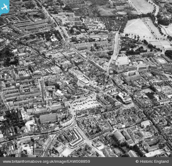
EAW008859 ENGLAND (1947). The town centre, Northampton, 1947
© Copyright OpenStreetMap contributors and licensed by the OpenStreetMap Foundation. 2025. Cartography is licensed as CC BY-SA.
Nearby Images (14)
Details
| Title | [EAW008859] The town centre, Northampton, 1947 |
| Reference | EAW008859 |
| Date | 9-August-1947 |
| Link | |
| Place name | NORTHAMPTON |
| Parish | |
| District | |
| Country | ENGLAND |
| Easting / Northing | 475592, 260522 |
| Longitude / Latitude | -0.89290083444779, 52.237295195948 |
| National Grid Reference | SP756605 |


![[EAW008859] The town centre, Northampton, 1947](http://britainfromabove.org.uk/sites/all/libraries/aerofilms-images/public/100x100/EAW/008/EAW008859.jpg)
![[EAW009511] The town, Northampton, 1947](http://britainfromabove.org.uk/sites/all/libraries/aerofilms-images/public/100x100/EAW/009/EAW009511.jpg)
![[EAW025947] The town, Northampton, from the south-west, 1949](http://britainfromabove.org.uk/sites/all/libraries/aerofilms-images/public/100x100/EAW/025/EAW025947.jpg)
![[EPW057745] Market Square, All Saints' Church and the town centre, Northampton, 1938. This image has been produced from a damaged negative.](http://britainfromabove.org.uk/sites/all/libraries/aerofilms-images/public/100x100/EPW/057/EPW057745.jpg)
![[EPW057749] All Saints' Church, Market Square and the town centre, Northampton, 1938. This image has been produced from a damaged negative.](http://britainfromabove.org.uk/sites/all/libraries/aerofilms-images/public/100x100/EPW/057/EPW057749.jpg)
![[EPW057743] Derngate, St Giles' Street and the town centre, Northampton, 1938. This image has been produced from a damaged negative.](http://britainfromabove.org.uk/sites/all/libraries/aerofilms-images/public/100x100/EPW/057/EPW057743.jpg)
![[EPW057748] All Saints' Church, Market Square and the town centre, Northampton, 1938. This image has been produced from a damaged negative.](http://britainfromabove.org.uk/sites/all/libraries/aerofilms-images/public/100x100/EPW/057/EPW057748.jpg)
![[EPW034347] Abington Street and the Market Square, Northampton, 1930](http://britainfromabove.org.uk/sites/all/libraries/aerofilms-images/public/100x100/EPW/034/EPW034347.jpg)
![[EAW008860] The town centre, Northampton, from the south-west, 1947](http://britainfromabove.org.uk/sites/all/libraries/aerofilms-images/public/100x100/EAW/008/EAW008860.jpg)
![[EAW025946] The town centre, Northampton, 1949](http://britainfromabove.org.uk/sites/all/libraries/aerofilms-images/public/100x100/EAW/025/EAW025946.jpg)
![[EAW008858] The town centre, Northampton, 1947](http://britainfromabove.org.uk/sites/all/libraries/aerofilms-images/public/100x100/EAW/008/EAW008858.jpg)
![[EPW045599] The town, Northampton, from the south, 1934. This image has been produced from a copy-negative.](http://britainfromabove.org.uk/sites/all/libraries/aerofilms-images/public/100x100/EPW/045/EPW045599.jpg)
![[EPW057747] Lady's Lane, Wood Street and the town centre, Northampton, 1938. This image has been produced from a damaged negative.](http://britainfromabove.org.uk/sites/all/libraries/aerofilms-images/public/100x100/EPW/057/EPW057747.jpg)
![[EAW009510] Beckett's Park and the town, Northampton, 1947](http://britainfromabove.org.uk/sites/all/libraries/aerofilms-images/public/100x100/EAW/009/EAW009510.jpg)
