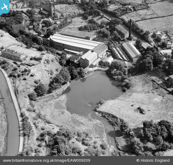
EAW009209 ENGLAND (1947). Clough Lee Mills and Mill Pond, Marsden, 1947
© Copyright OpenStreetMap contributors and licensed by the OpenStreetMap Foundation. 2025. Cartography is licensed as CC BY-SA.
Nearby Images (7)
Details
| Title | [EAW009209] Clough Lee Mills and Mill Pond, Marsden, 1947 |
| Reference | EAW009209 |
| Date | 16-August-1947 |
| Link | |
| Place name | MARSDEN |
| Parish | |
| District | |
| Country | ENGLAND |
| Easting / Northing | 404414, 411711 |
| Longitude / Latitude | -1.9332902799016, 53.601708099542 |
| National Grid Reference | SE044117 |
Pins
 John W |
Friday 14th of May 2021 09:50:47 PM | |
 MarsdenEnthusiast |
Tuesday 12th of April 2016 10:45:32 PM | |
 MarsdenEnthusiast |
Tuesday 12th of April 2016 10:43:26 PM |


![[EAW009209] Clough Lee Mills and Mill Pond, Marsden, 1947](http://britainfromabove.org.uk/sites/all/libraries/aerofilms-images/public/100x100/EAW/009/EAW009209.jpg)
![[EAW009208] Clough Lee Mills, Marsden, 1947](http://britainfromabove.org.uk/sites/all/libraries/aerofilms-images/public/100x100/EAW/009/EAW009208.jpg)
![[EAW009205] Clough Lee Mills and Mill Pond, Marsden, 1947](http://britainfromabove.org.uk/sites/all/libraries/aerofilms-images/public/100x100/EAW/009/EAW009205.jpg)
![[EAW009210] Clough Lee Mills and Mill Pond, Marsden, 1947](http://britainfromabove.org.uk/sites/all/libraries/aerofilms-images/public/100x100/EAW/009/EAW009210.jpg)
![[EAW009206] Clough Lee Mills, Marsden, 1947](http://britainfromabove.org.uk/sites/all/libraries/aerofilms-images/public/100x100/EAW/009/EAW009206.jpg)
![[EAW009207] Clough Lee Mills, Marsden, 1947](http://britainfromabove.org.uk/sites/all/libraries/aerofilms-images/public/100x100/EAW/009/EAW009207.jpg)
![[EAW009204] Clough Lee Mills and Mill Pond, Marsden, 1947](http://britainfromabove.org.uk/sites/all/libraries/aerofilms-images/public/100x100/EAW/009/EAW009204.jpg)