
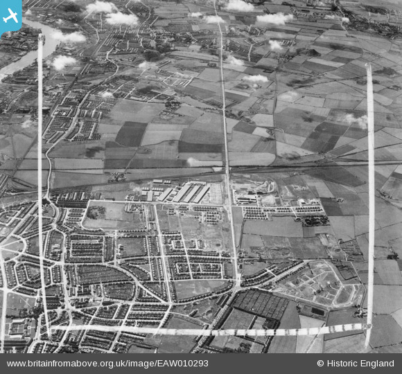
EAW010293 ENGLAND (1947). Development around West Chirton and Billy Mill, West Chirton, from the north-east, 1947. This image was marked by Aerofilms Ltd for photo editing.
© Copyright OpenStreetMap contributors and licensed by the OpenStreetMap Foundation. 2025. Cartography is licensed as CC BY-SA.
Nearby Images (7)
EAW010293

EAW010286

EAW010294

EAW010284

EAW010285

EAW010280

EAW010287

Details
| Title | [EAW010293] Development around West Chirton and Billy Mill, West Chirton, from the north-east, 1947. This image was marked by Aerofilms Ltd for photo editing. |
| Reference | EAW010293 |
| Date | 24-August-1947 |
| Link | |
| Place name | WEST CHIRTON |
| Parish | |
| District | |
| Country | ENGLAND |
| Easting / Northing | 433734, 568843 |
| Longitude / Latitude | -1.4724238053168, 55.012924878487 |
| National Grid Reference | NZ337688 |
Pins
 russellwynn@mail.com |
Wednesday 11th of October 2023 06:26:46 PM | |
russellwynn@mail.com |
Wednesday 11th of October 2023 06:25:57 PM | |
russellwynn@mail.com |
Wednesday 11th of October 2023 06:25:25 PM | |
russellwynn@mail.com |
Wednesday 11th of October 2023 06:24:43 PM | |
russellwynn@mail.com |
Wednesday 11th of October 2023 06:24:14 PM | |
russellwynn@mail.com |
Wednesday 11th of October 2023 06:23:40 PM | |
russellwynn@mail.com |
Wednesday 11th of October 2023 06:23:06 PM | |
russellwynn@mail.com |
Wednesday 11th of October 2023 06:22:32 PM |