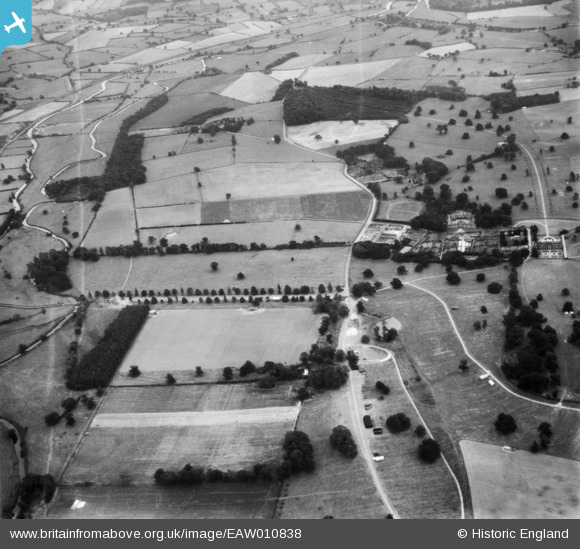
EAW010838 ENGLAND (1947). Trent Walk, Ingestre Hall and surrounding countryside, Ingestre, 1947
© Copyright OpenStreetMap contributors and licensed by the OpenStreetMap Foundation. 2025. Cartography is licensed as CC BY-SA.
Nearby Images (8)
Details
| Title | [EAW010838] Trent Walk, Ingestre Hall and surrounding countryside, Ingestre, 1947 |
| Reference | EAW010838 |
| Date | 13-September-1947 |
| Link | |
| Place name | INGESTRE |
| Parish | INGESTRE |
| District | |
| Country | ENGLAND |
| Easting / Northing | 398060, 324972 |
| Longitude / Latitude | -2.0287920805045, 52.821948511178 |
| National Grid Reference | SJ981250 |
Pins
Be the first to add a comment to this image!


![[EAW010838] Trent Walk, Ingestre Hall and surrounding countryside, Ingestre, 1947](http://britainfromabove.org.uk/sites/all/libraries/aerofilms-images/public/100x100/EAW/010/EAW010838.jpg)
![[EAW010836] Trent Walk, Alder Coppice and surrounding countryside, Ingestre, 1947. This image was marked by Aerofilms Ltd for photo editing.](http://britainfromabove.org.uk/sites/all/libraries/aerofilms-images/public/100x100/EAW/010/EAW010836.jpg)
![[EAW010841] Home Farm, Ingestre, 1947](http://britainfromabove.org.uk/sites/all/libraries/aerofilms-images/public/100x100/EAW/010/EAW010841.jpg)
![[EAW010842] Home Farm, Ingestre, 1947](http://britainfromabove.org.uk/sites/all/libraries/aerofilms-images/public/100x100/EAW/010/EAW010842.jpg)
![[EAW010843] Home Farm, Ingestre, 1947](http://britainfromabove.org.uk/sites/all/libraries/aerofilms-images/public/100x100/EAW/010/EAW010843.jpg)
![[EAW010844] Home Farm, Ingestre, 1947](http://britainfromabove.org.uk/sites/all/libraries/aerofilms-images/public/100x100/EAW/010/EAW010844.jpg)
![[EAW010840] Home Farm, Ingestre, 1947](http://britainfromabove.org.uk/sites/all/libraries/aerofilms-images/public/100x100/EAW/010/EAW010840.jpg)
![[EAW010835] Trent Walk, Alder Coppice and surrounding countryside, Ingestre, 1947. This image was marked by Aerofilms Ltd for photo editing.](http://britainfromabove.org.uk/sites/all/libraries/aerofilms-images/public/100x100/EAW/010/EAW010835.jpg)