
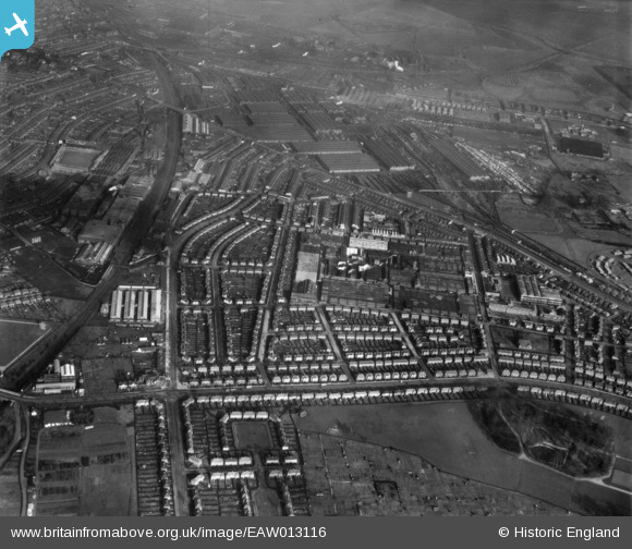
EAW013116 ENGLAND (1948). The Rolls Royce Nightingale Road Works and surrounding residential district, Osmaston, 1948
© Copyright OpenStreetMap contributors and licensed by the OpenStreetMap Foundation. 2025. Cartography is licensed as CC BY-SA.
Nearby Images (13)
EAW013116

EAW013113

EPW045454

EPW046677

EAW013119

EAW013110

EPW046661

EPW046678

EPW046660

EAW013111

EAW013115

EAW013124

EPW045453

Details
| Title | [EAW013116] The Rolls Royce Nightingale Road Works and surrounding residential district, Osmaston, 1948 |
| Reference | EAW013116 |
| Date | 4-February-1948 |
| Link | |
| Place name | OSMASTON |
| Parish | |
| District | |
| Country | ENGLAND |
| Easting / Northing | 436144, 333686 |
| Longitude / Latitude | -1.462622724796, 52.899079199669 |
| National Grid Reference | SK361337 |
Pins
 Sparky |
Wednesday 18th of October 2017 11:43:22 PM | |
Triggy |
Sunday 16th of August 2015 06:27:44 PM | |
Triggy |
Sunday 16th of August 2015 06:26:30 PM | |
Triggy |
Sunday 16th of August 2015 06:25:22 PM | |
Triggy |
Sunday 16th of August 2015 06:24:30 PM | |
Triggy |
Sunday 16th of August 2015 06:23:39 PM | |
Triggy |
Sunday 16th of August 2015 06:22:18 PM | |
Triggy |
Sunday 16th of August 2015 06:21:28 PM |