
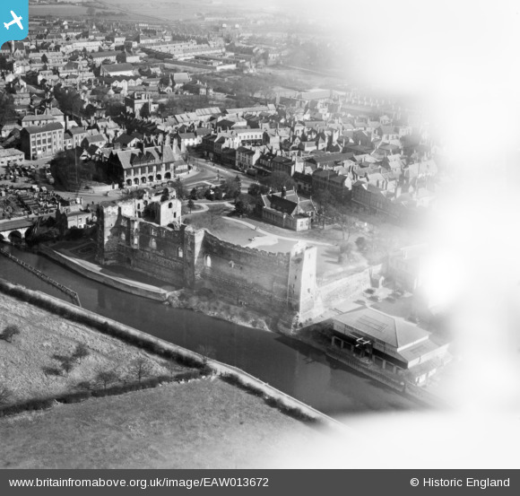
EAW013672 ENGLAND (1948). The castle, Newark-on-Trent, 1948. This image has been affected by flare.
© Copyright OpenStreetMap contributors and licensed by the OpenStreetMap Foundation. 2025. Cartography is licensed as CC BY-SA.
Nearby Images (21)
EAW013672

EPW015267

EAW006308

EAW006306

EAW006307

EPW016193

EAW006304

EAW016512

EAW006303

EAW016508

EPW013025

EPW015268

EAW016511

EAW013673

EAW016510

EAW006301

EAW016509

EAW013675

EPW015269

EPW015270

EPW013023

Details
| Title | [EAW013672] The castle, Newark-on-Trent, 1948. This image has been affected by flare. |
| Reference | EAW013672 |
| Date | 10-March-1948 |
| Link | |
| Place name | NEWARK-ON-TRENT |
| Parish | NEWARK |
| District | |
| Country | ENGLAND |
| Easting / Northing | 479665, 354028 |
| Longitude / Latitude | -0.81066431259866, 53.077230934536 |
| National Grid Reference | SK797540 |
Pins
Be the first to add a comment to this image!