
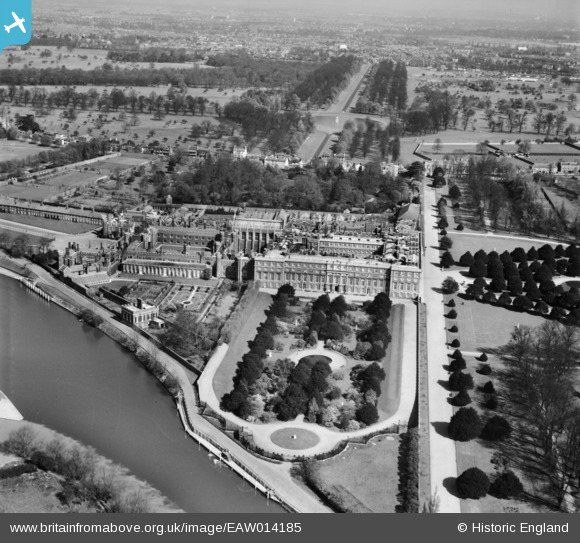
EAW014185 ENGLAND (1948). Hampton Court Palace, Hampton Court Park, from the south, 1948
© Copyright OpenStreetMap contributors and licensed by the OpenStreetMap Foundation. 2025. Cartography is licensed as CC BY-SA.
Nearby Images (31)
EAW014185

EPW001711

EAW014186

EPW001713

EPW031566

EPW001712

EPW022946

EAW023684

EPW022853

EAW014181

EPW010997

EPW009439

EPW022852

EAW023683

EPW060551

EPW001716

EAW018711

EAW014184

EAW014182

EPW060550

EPW008866

EAW003680

EPW022848

EAW002300

EAW018712

EAW023679

EAW002302

EAW002301

EPW060552

EPW049573

EPW060549

Details
| Title | [EAW014185] Hampton Court Palace, Hampton Court Park, from the south, 1948 |
| Reference | EAW014185 |
| Date | 7-April-1948 |
| Link | |
| Place name | HAMPTON COURT PARK |
| Parish | |
| District | |
| Country | ENGLAND |
| Easting / Northing | 515735, 168289 |
| Longitude / Latitude | -0.33603419414249, 51.401314486244 |
| National Grid Reference | TQ157683 |
Pins
 Alan McFaden |
Wednesday 8th of January 2014 05:18:11 PM | |
Alan McFaden |
Wednesday 8th of January 2014 05:17:36 PM | |
 Pip |
Thursday 2nd of January 2014 03:42:54 AM |

