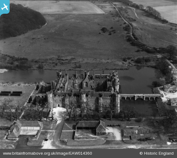
EAW014360 ENGLAND (1948). Herstmonceux Castle, Herstmonceux, 1948. This image has been produced from a print.
© Copyright OpenStreetMap contributors and licensed by the OpenStreetMap Foundation. 2025. Cartography is licensed as CC BY-SA.
Nearby Images (7)
Details
| Title | [EAW014360] Herstmonceux Castle, Herstmonceux, 1948. This image has been produced from a print. |
| Reference | EAW014360 |
| Date | 13-April-1948 |
| Link | |
| Place name | HERSTMONCEUX |
| Parish | HERSTMONCEUX |
| District | |
| Country | ENGLAND |
| Easting / Northing | 564687, 110383 |
| Longitude / Latitude | 0.34075223721292, 50.868901695398 |
| National Grid Reference | TQ647104 |
Pins
 redmist |
Friday 3rd of November 2023 08:44:53 PM |


![[EAW014360] Herstmonceux Castle, Herstmonceux, 1948. This image has been produced from a print.](http://britainfromabove.org.uk/sites/all/libraries/aerofilms-images/public/100x100/EAW/014/EAW014360.jpg)
![[EAW001453] Herstmonceaux Castle, Herstmonceaux, 1946](http://britainfromabove.org.uk/sites/all/libraries/aerofilms-images/public/100x100/EAW/001/EAW001453.jpg)
![[EAW014361] Herstmonceux Castle, Herstmonceux, 1948. This image has been produced from a print.](http://britainfromabove.org.uk/sites/all/libraries/aerofilms-images/public/100x100/EAW/014/EAW014361.jpg)
![[EAW001454] Herstmonceaux Castle, Herstmonceaux, 1946](http://britainfromabove.org.uk/sites/all/libraries/aerofilms-images/public/100x100/EAW/001/EAW001454.jpg)
![[EAW014362] Herstmonceux Castle, Herstmonceux, 1948. This image has been produced from a damaged negative.](http://britainfromabove.org.uk/sites/all/libraries/aerofilms-images/public/100x100/EAW/014/EAW014362.jpg)
![[EAW014359] Herstmonceux Castle, Herstmonceux, 1948. This image has been produced from a print.](http://britainfromabove.org.uk/sites/all/libraries/aerofilms-images/public/100x100/EAW/014/EAW014359.jpg)
![[EAW001455] Herstmonceaux Castle, Herstmonceaux, 1946](http://britainfromabove.org.uk/sites/all/libraries/aerofilms-images/public/100x100/EAW/001/EAW001455.jpg)